Short answer: Grant-Valkaria is reached by U.S. 1 (State Road 5) and Babcock Street, and FDOT is designing new traffic signals at U.S. 1 and Valkaria Road and at U.S. 1 and 1st Street, both with an August 3, 2027 letting. Valkaria Airport (X59) is owned and run by Brevard County, with two 4,000-foot runways and 95 hangars. Workers average a 32.8 minute commute, and 27.0 percent work from home.
Last verified: October 15, 2026, against the sources listed at the end of this page.
Which roads lead into Grant-Valkaria?
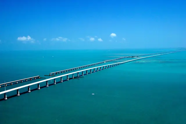
Grant can be entered from U.S. 1, which FDOT lists as State Road 5, or from Babcock Street (FDOT; Grant Seafood Festival directions).
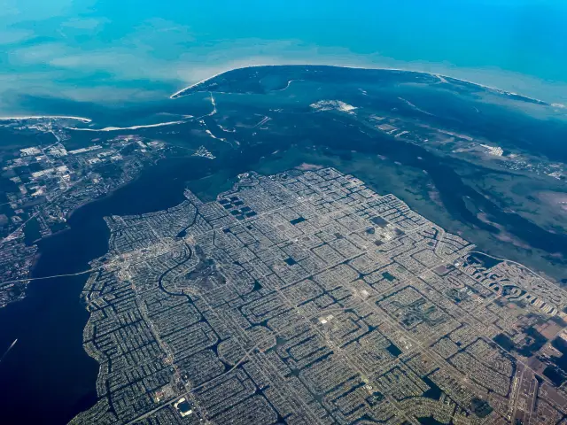
The Grant Seafood Festival publishes a step-by-step route into Grant from I-95. From the north, drivers take exit 173 (Palm Bay and Malabar), follow SR 514 east for 4.2 miles and turn right on U.S. 1 for 5.8 miles. From the south, they take exit 156 (Fellsmere and Sebastian), follow Roseland Road (CR 505) for 4.7 miles and turn left on U.S. 1 for 6.6 miles (festival directions). From Babcock Street, Valkaria Road enters from the north and Grant Road from the south. The organizer places Grant about 12 miles south of Melbourne, 22 miles north of Vero and roughly an hour and a half east of Orlando (Grant Seafood Festival).
The same organizer page warns drivers that Brighline trains use three crossings in Grant and that no one should stop on the tracks (festival information).
What is FDOT building on U.S. 1 in Grant-Valkaria?
The Florida Department of Transportation is designing two new traffic signals on U.S. 1 in Grant-Valkaria, at Valkaria Road and at 1st Street, both set for a construction letting on August 3, 2027 (FDOT 454250-1; FDOT 454251-1).
| Project | Intersection | Phase | Design cost | Construction estimate | Letting |
|---|---|---|---|---|---|
| 454250-1 | U.S. 1 at Valkaria Road | Design | $475,000 | $1.3 million | August 3, 2027 |
| 454251-1 | U.S. 1 at 1st Street | Design | $530,000 | $1.2 million | August 3, 2027 |
At Valkaria Road, project 454250-1 adds a new signal to improve safety and adds intersection lighting (FDOT project 454250-1). At 1st Street, project 454251-1 builds a signal on mast arm poles, rebuilds the curb ramps with pedestrian landings, adds a crosswalk and includes drainage work (FDOT project 454251-1). In dollars, the Valkaria Road signal carries a $475,000 design budget and a $1.3 million construction estimate, and the 1st Street signal $530,000 for design and $1.2 million for construction. 1st Street is also the address of the Grant community grounds, 4580 1st Street, where the Grant Seafood Festival is held (festival information).
Both Grant-Valkaria signal projects are listed in the design phase as of October 15, 2026, with the letting date more than nine months away. The Valkaria Road project page was last updated July 24, 2026, and both pages carry a form to send a comment or ask a question about the project; the design project manager's line is (386) 943-5591 (FDOT contact).
What is Valkaria Airport, and who runs it?
Valkaria Airport (FAA code X59) is a general aviation airport owned and operated by Brevard County, with two intersecting 4,000-foot runways, 10/28 and 14/32 (Brevard County).
The county lists 95 full-size hangars at Valkaria Airport and keeps separate waiting lists for half, large, rotorcraft and standard hangars. An on-site Super AWOS gives pilots current field conditions by radio or online. The airport office is at #1 Pilots' Place, Valkaria, FL 32950, phone (321) 952-4590 (Valkaria Airport office).
The FAA record adds the operating details. Valkaria Airport sits at 25.8 feet elevation, 1 mile west of Valkaria, is open to the public and has no control tower; pilots use the common traffic frequency, 122.725 MHz, which is also the automated UNICOM (FAA airport data). The field is attended Monday through Friday from 8:00 to 17:00, sells 100LL fuel and charges no landing fee. Runway 10/28 measures 4,000 by 60 feet of asphalt in fair condition.
Night and instrument details are in the same Valkaria Airport record. Runway 14/32 has medium intensity edge lights that pilots switch on from sunset to sunrise over the 122.725 MHz frequency, and the runway 14 end carries non-precision instrument markings with a left traffic pattern (FAA runway data). The runway 28 end has a four-light PAPI on the right side for a 3 degree glide path. Radar approach and departure service for Grant-Valkaria traffic comes from Orlando Approach on 126.025 MHz, and the airport lies on the Miami sectional chart.
Two items in the FAA data for October 1 to 29, 2026 are worth checking before flying in to Grant-Valkaria: an active construction notice for the airport, and a remark that the runway 28 markings are stained or discolored (FAA remarks). The Valkaria Airport guide covers the runways, frequencies and county rules in full.
How do Grant-Valkaria residents get to work?
Grant-Valkaria commuters drive: in the ACS 2020-2024 5-year estimates, 65.7 percent of workers drove alone, 3.4 percent carpooled and 0.0 percent used public transportation or walked, each with a margin of error of plus or minus 3.1 points (ACS DP03, Grant-Valkaria).
The average Grant-Valkaria trip to work takes 32.8 minutes, against 25.4 minutes across Brevard County, where 74.6 percent of workers drive alone (ACS DP03, Brevard County). The town also has a high work-from-home rate: 27.0 percent of the town's 1,664 workers worked from home, close to double the county share of 14.6 percent.
Households in Grant-Valkaria are well supplied with vehicles. Only 4.9 percent of occupied homes have no vehicle, while 32.6 percent have three or more (ACS DP04, Grant-Valkaria). The survey's 0.0 percent public transportation share for Grant-Valkaria workers compares with 65.7 percent who drive alone.
How does Grant-Valkaria plan for walkers, cyclists and horse riders?
The Grant-Valkaria Town Council's mission says town streets, bridges and transit stops should let pedestrians, bicyclists, transit riders, equestrians and motorists of all ages travel safely and independently (Town of Grant-Valkaria).
Equestrians are named alongside drivers in that Grant-Valkaria mission statement. The same statement commits the town to keep its infrastructure ready for current and future needs and to improve the look of its main thoroughfares (Grant-Valkaria mission statements).
The FDOT 1st Street project, now in design, aims to enhance driver and pedestrian safety with rebuilt curb ramps for pedestrian landings and a new crosswalk (FDOT 454251-1). The census data shows the starting point: the share of Grant-Valkaria workers who walked to work is 0.0 percent, plus or minus 3.1 points (ACS DP03).
How does traffic work in Grant-Valkaria during the Grant Seafood Festival?
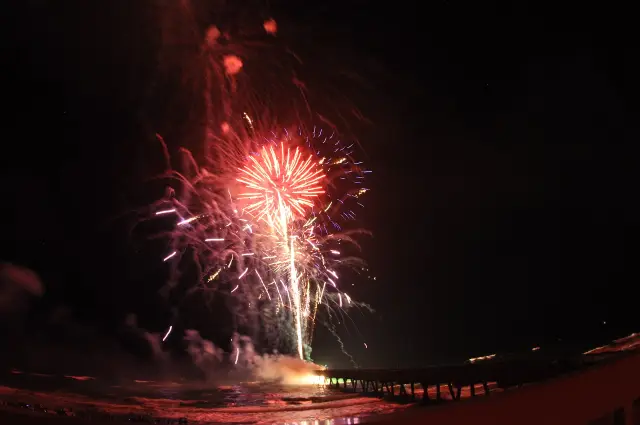
During the Grant Seafood Festival, parking moves to Valkaria Airport, with shuttles on a continuous loop to the festival grounds at 4580 1st Street (Grant Seafood Festival information).
Drivers heading north on U.S. 1 are routed off at Shell Pit Road, and drivers heading south are turned onto Valkaria Road and follow signs to parking; a park and ride lot sits on Valkaria Road across from The Habitat Golf Course. Festival tickets can also be bought at the airport parking site from 10 a.m. to 3 p.m. on both days. One stale detail: on October 15, 2026 the shuttle schedule on the organizer page still listed March 7 and 8, 2026 hours, while the festival itself is set for March 6 and 7, 2027 (festival information). The Grant-Valkaria events hub covers the festival dates and rules.
Which Grant-Valkaria transportation guide answers which question?
The Valkaria Airport guide is the Grant-Valkaria transportation section's deep page; road and commute questions are answered on this hub.
| Question | Key fact | Where |
|---|---|---|
| Who runs Valkaria Airport? | Brevard County; two 4,000-foot runways, 95 hangars | Valkaria Airport guide |
| What frequency does X59 use? | CTAF and UNICOM 122.725 MHz, no tower | Valkaria Airport guide |
| When will U.S. 1 get new signals? | Valkaria Road and 1st Street, letting August 3, 2027 | This hub |
| How long is the commute? | 32.8 minutes average; 27.0% work from home | This hub |
Frequently asked questions
Is there a traffic light at U.S. 1 and Valkaria Road?
Not yet. FDOT project 454250-1 is designing a new traffic signal with intersection lighting at U.S. 1 and Valkaria Road in Grant-Valkaria, with a construction letting set for August 3, 2027 and an estimated construction cost of $1.3 million.
Who owns Valkaria Airport?
Brevard County owns and operates Valkaria Airport in Grant-Valkaria. The county lists two intersecting 4,000-foot runways, 10/28 and 14/32, and 95 full-size hangars, and the airport office at #1 Pilots' Place answers at (321) 952-4590.
Does Valkaria Airport have a control tower?
No. The FAA lists Valkaria Airport (X59) as open to the public with no control tower. Pilots use the common traffic advisory frequency, 122.725 MHz, and the field is attended Monday through Friday from 8:00 to 17:00 with 100LL fuel.
Do Grant-Valkaria workers commute by public transportation?
Almost none are counted. The ACS 2020-2024 5-year estimates record 0.0 percent, plus or minus 3.1 points, of Grant-Valkaria workers commuting by public transportation; 65.7 percent drive alone and 27.0 percent work from home. The town mission statement still lists transit stops among the facilities it plans for.
Which I-95 exit is closest to Grant-Valkaria?
The Grant Seafood Festival directions use I-95 exit 173 (Palm Bay and Malabar) from the north, then SR 514 east and a right turn on U.S. 1, and exit 156 (Fellsmere and Sebastian) from the south, then Roseland Road and a left turn on U.S. 1.
Sources
- FDOT project 454250-1, U.S. 1 at Valkaria Road (CFLRoads) https://www.cflroads.com/project/454250-1 Used for: Valkaria Road signal: phase, design and construction cost, letting date, lighting
- FDOT project 454251-1, U.S. 1 at 1st Street Signal (CFLRoads) https://www.cflroads.com/project/454251-1 Used for: 1st Street signal: mast arms, curb ramps, crosswalk, drainage, costs, letting date
- Valkaria Airport, Brevard County https://www.brevardfl.gov/ValkariaAirport Used for: ownership, runways, hangars, hangar waiting lists, Super AWOS, office address and phone
- X59 Valkaria airport data, FAA National Airspace System Resource (NFDC) https://nfdc.faa.gov/nfdcApps/services/ajv5/airportDisplay.jsp?airportId=X59 Used for: elevation, public use, no tower, CTAF, attendance, fuel, runway dimensions and condition, construction notice
- ACS 2020-2024 5-year DP03, Grant-Valkaria town, Florida (U.S. Census Bureau) https://data.census.gov/api/access/data/table?id=ACSDP5Y2024.DP03&g=160XX00US1227256 Used for: commute time, drove alone, carpool, transit, worked from home
- ACS 2020-2024 5-year DP04, Grant-Valkaria town, Florida (U.S. Census Bureau) https://data.census.gov/api/access/data/table?id=ACSDP5Y2024.DP04&g=160XX00US1227256 Used for: vehicles available per household
- ACS 2020-2024 5-year DP03, Brevard County, Florida (U.S. Census Bureau) https://data.census.gov/api/access/data/table?id=ACSDP5Y2024.DP03&g=050XX00US12009 Used for: county commute time, drove alone, work from home
- Town Council, Town of Grant-Valkaria https://www.grantvalkaria.org/bc-town-council Used for: mission statement on streets, bridges and transit stops for all users
- Festival Information, Grant Seafood Festival https://www.grantseafoodfestival.com/information Used for: I-95 exits and routes into Grant, Babcock Street, Brighline crossings, airport shuttle parking
How this page was made
Digital Towns uses AI assistance to research and write its guides, and every page is only as good as the sources it cites. Our goal is the most accurate, useful local information possible.
This page was fact-checked twice before publishing.
If you see an error, or anything you can show is false, tell us right away and we will take a third look.
Report an error
Thank you. We'll take a third look and correct the page if it's wrong.