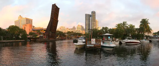
Short answer: The New River runs from the Intracoastal Waterway west through downtown Fort Lauderdale before forking into the North and South Forks. Four drawbridges cross it downtown; the three road bridges may stay shut 7:30 to 9 a.m. and 4:30 to 6 p.m. on weekdays. The river is a year-round slow speed manatee zone, the city rents 100 downtown slips, and Smoker Park has a free 24 hour pump-out.
Last verified: October 19, 2026, against the sources listed at the end of this page.
Where does the New River run through Fort Lauderdale?
The New River runs west from the Intracoastal Waterway near Cordova Road through downtown Fort Lauderdale, then splits into a North Fork and a South Fork, with the North New River Canal and South New River Canal farther west.
The clearest official outline is the state manatee rule for Broward County. Its New River Area takes in the New River, Tarpon River, North Fork New River and South Fork New River west of the northerly extension of Cordova Road, east of a salinity control structure in the North Fork about 600 feet west of NW 34th Avenue, and east of SW 27th Avenue across the South Fork, including Marina Bay just west of Interstate 95 (Florida Administrative Code, Rule 68C-22.010). East of Cordova Road, the rule groups the river with the Stranahan River, the Port Everglades Turning Basin, Lake Mable and the Intracoastal Waterway.
The Coast Guard counts river miles along the same channel: the SE Third Avenue bridge sits at mile 1.4, Andrews Avenue at mile 2.3, the Florida East Coast Railroad bridge at mile 2.5 and the Seventh Avenue bridge at mile 2.7 (eCFR, 33 CFR 117.313). The City of Fort Lauderdale counts 165 miles of navigable waterways in the city as a whole (City of Fort Lauderdale, Marine Facilities).
When do the New River drawbridges open?
Three New River road drawbridges open on signal except during weekday rush hours, and the Florida East Coast Railroad bridge stays open except when a train, inspection or maintenance closes it.
| Bridge | River mile | Rule |
|---|---|---|
| SE Third Avenue | 1.4 | Opens on signal; need not open 7:30 to 9 a.m. and 4:30 to 6 p.m., Monday through Friday except federal holidays |
| Andrews Avenue | 2.3 | Same rush hour exception; need not open for inbound vessels while the FEC bridge is down for a train |
| Florida East Coast Railroad | 2.5 | Kept open except for rail traffic, inspections and maintenance; never closed more than 60 consecutive minutes |
| Seventh Avenue (Marshal) | 2.7 | Opens on signal; same weekday rush hour exception |
The railroad bridge carries a fixed schedule: it must open for 10 minutes each hour from 5 a.m. to 11:59 p.m., with set openings at 7:00, 9:00 a.m., 4:00, 6:00 and 10:00 p.m., plus a second 10 minute opening in each hour from noon to 2:59 p.m. (eCFR, 33 CFR 117.313). Its tender is on site at all times and gives operating information 24 hours a day on VHF-FM channels 9 and 16 or by telephone at (305) 889-5572; green lights mean vessels may pass, flashing red means a train is coming. Public vessels, tugs with tows and vessels in distress may pass any of the road bridges at any time.
For a skipper heading upriver from the Intracoastal on a weekday, the practical window is outside 7:30 to 9 a.m. and 4:30 to 6 p.m., timed to an FEC opening, because the Andrews Avenue draw may stay down for inbound boats while the railroad bridge is closed for a train (Coast Guard New River rule).
How fast can boats go on the New River?
The New River through Fort Lauderdale is a year-round slow speed manatee zone under state rule, and parts of the South Fork and the New River canals farther west are idle speed.
Rule 68C-22.010 lists the New River Area, from Cordova Road west to the North Fork salinity structure and SW 27th Avenue on the South Fork, under its Slow Speed zones, with no seasonal limit on that zone (Florida Administrative Code, Rule 68C-22.010). West of SW 27th Avenue, the waters of the South Fork New River, North New River Canal and South New River Canal, east of SW 34th Avenue and north of a line about 1,300 feet southwest of the eastbound Interstate 595 bridge, are an Idle Speed zone, which includes the Florida Power and Light canal that joins the South Fork north of the State Road 84 bridge.
The Broward County Zones rule belongs to the Florida Fish and Wildlife Conservation Commission and has been amended several times since its first version on 3-19-79; the current text took effect on 11/14/2011 (Florida Department of State, Rule 68C-22.010).
Where can boaters dock on the New River downtown?
The City of Fort Lauderdale rents slips at New River/Downtown Docking, 100 slips with full utilities on the downtown promenade off Las Olas Boulevard, and runs Cooley's Landing marina with a boat ramp.
New River/Downtown Docking offers cable, electric, phone, sewage and water connections at each slip and is managed from the main marine office at 450 SW 7th Ave, phone (954) 828-4626, open daily from 8 a.m. to 5 p.m. (City of Fort Lauderdale, New River/Downtown Docking). The city describes the slips as sitting on a brick-paved promenade within walking distance of shops and sidewalk cafes.
Cooley's Landing, at the same 450 SW 7th Ave address, covers 2.96 acres and adds a boat ramp, fishing, a renovated comfort station with showers and a laundromat, picnic tables, a pavilion and parking (City of Fort Lauderdale, Cooley’s Landing). The city says all of its marine facilities are open to the public on a first come, first served basis, monitors VHF channel 9, and has had them designated Clean Marinas by the Florida Clean Marina Program (City of Fort Lauderdale, Marine Facilities). Rates sit on a separate dockage rate card.
Where can boats pump out sewage for free on the New River?
The City of Fort Lauderdale runs four free sewage pump-out stations for boaters, including Smoker Park, Marshall Point and the Cooley's Landing marina.
Smoker Park at 501 S. New River Drive is self-service 24 hours a day, as is the fourth station at Cox's Landing Boat Ramp, 1784 SE 15th Street. Marshall Point and Cooley's Landing Marina, 450 SW 7th Avenue, are assisted service only, from 8:30 a.m. to 4 p.m. (City of Fort Lauderdale, Marine Facilities).
Two details on the city pages need checking before a trip. Marshall Point is listed at 401 SW 4th Avenue in one pump-out list and at 410 SW 4th Avenue in another on the same New River docking page (New River/Downtown Docking). And the marine pages still say mobile sewage pump out service is coming spring 2026, a date that has passed with no update posted as of October 18, 2026; boaters should call the marine office at (954) 828-5423 or (954) 828-4626 to ask whether it has started.
How do king tides affect the New River in Fort Lauderdale?
King tides temporarily flood Fort Lauderdale's lowest-lying neighborhoods, and the city page relays a NOAA prediction of king tides on at least 40 days in 2026, including late October, November and late December.
The city's predicted 2026 king tide periods still ahead include October 24 to 31, November 5 to 11, November 22 to 28 and December 24 to 25, and the city warns that rain, wind and high water tables can raise local tides even higher (City of Fort Lauderdale, King Tides and High Tides). To track the river itself, the city monitors a city-installed tide gauge on the New River for accurate local tide measurement.
For riverfront property, the city requires new seawalls to be built to a minimum top elevation of 5 feet, inspects and maintains 215 tidal valves, and invests $1.5 million a year in restoring and raising city-owned seawalls under its Phase 2 Seawall Master Plan (City of Fort Lauderdale king tides). Flooded roads, unusual flooding or clogged storm drains go to the city's Customer Support Center at 954-828-8000 or the FixIt FTL app.
Last verified: October 18, 2026, against the Coast Guard drawbridge rule for the New River on eCFR, Florida rule 68C-22.010, and the City of Fort Lauderdale marina, docking and king tide pages.
Frequently asked questions
Do the New River bridges open during rush hour?
No. The SE Third Avenue, Andrews Avenue and Seventh Avenue drawbridges need not open from 7:30 to 9 a.m. and 4:30 to 6 p.m. on weekdays except federal holidays, under 33 CFR 117.313.
What is the speed limit on the New River in Fort Lauderdale?
The New River Area is a year-round slow speed manatee zone under Florida rule 68C-22.010. Parts of the South Fork New River and the New River canals west of SW 27th Avenue are idle speed.
How many slips does the city have on the New River downtown?
New River/Downtown Docking has 100 slips with full utilities. The marine office at 450 SW 7th Ave answers at (954) 828-4626, daily 8 a.m. to 5 p.m.
Is there a free pump-out on the New River?
Yes. Smoker Park at 501 S. New River Drive is free self-service 24 hours a day, and Marshall Point and Cooley's Landing offer free assisted pump-outs from 8:30 a.m. to 4 p.m.
When is the next king tide on the New River?
The City of Fort Lauderdale lists predicted 2026 king tides for October 24 to 31, November 5 to 11, November 22 to 28 and December 24 to 25.
Sources
- eCFR, 33 CFR 117.313, New River (U.S. Coast Guard drawbridge operation regulations) https://www.ecfr.gov/current/title-33/chapter-I/subchapter-J/part-117/subpart-B/section-117.313 Used for: SE Third Avenue bridge mile 1.4, Andrews Avenue bridge mile 2.3, FEC Railroad bridge mile 2.5, Seventh Avenue bridge mile 2.7, rush hour closures, FEC 10 minute openings, 60 minute closure limit, VHF and phone
- Florida Administrative Code, Rule 68C-22.010, Broward County Zones (rule text) https://www.flrules.org/gateway/readFile.asp?sid=0&tid=10617540&type=1&file=68C-22.010.doc Used for: New River Area slow speed zone limits, idle speed zone in South Fork New River and the New River canals, Cordova Road boundary
- Florida Administrative Code, Rule 68C-22.010 page, Florida Department of State https://www.flrules.org/gateway/ruleNo.asp?id=68C-22.010 Used for: Fish and Wildlife Conservation Commission rule, effective date 11/14/2011, history since 1979
- City of Fort Lauderdale Parks and Recreation, New River/Downtown Docking https://www.parks.fortlauderdale.gov/programs/marinas/new-river-downtown-docking Used for: 100 slips with full utilities, 450 SW 7th Ave office, phone, daily 8 a.m. to 5 p.m., pump-out stations
- City of Fort Lauderdale Parks and Recreation, Cooley's Landing https://www.parks.fortlauderdale.gov/programs/marinas/cooley-s-landing Used for: boat ramp, comfort station with showers and laundromat, 2.96 acres, marina connections
- City of Fort Lauderdale Parks and Recreation, Marine Facilities https://www.parks.fortlauderdale.gov/programs/marinas Used for: 165 miles of navigable waterways, first-come first-served municipal docking, four free pump-outs, mobile pump-out coming spring 2026, VHF Ch 9, Clean Marinas
- City of Fort Lauderdale, King Tides and High Tides https://www.fortlauderdale.gov/Government/Departments/Strategic-Communications/King-Tides-and-High-Tides Used for: city tide gauge on the New River, 2026 king tide dates, at least 40 days predicted, 5 foot minimum seawall elevation, 215 tidal valves, 954-828-8000
How this page was made
Digital Towns uses AI assistance to research and write its guides, and every page is only as good as the sources it cites. Our goal is the most accurate, useful local information possible.
This page was fact-checked twice before publishing.
If you see an error, or anything you can show is false, tell us right away and we will take a third look.
Report an error
Thank you. We'll take a third look and correct the page if it's wrong.