









Short answer: Fort Lauderdale is the largest of Broward County's 31 municipalities, a 36 square mile Atlantic coast city with 165 miles of inland waterways and 185,604 residents in the ACS 2020-2024 estimate. A five-member City Commission led by Mayor Dean J. Trantalis sets policy under a Commission-Manager government. A majority of residents live in or near a FEMA flood zone, and the city's Fortify Lauderdale program commits up to $500 million to stormwater work in 17 neighborhoods.
Last verified: October 15, 2026, against the sources listed at the end of this page.
Where is Fort Lauderdale and how do people get there?
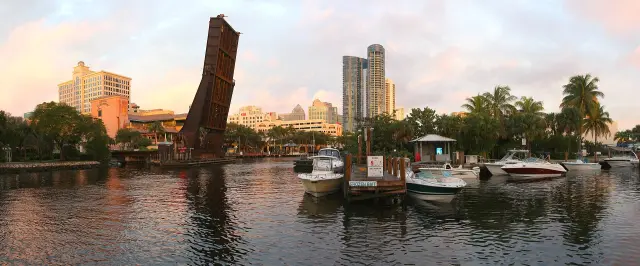
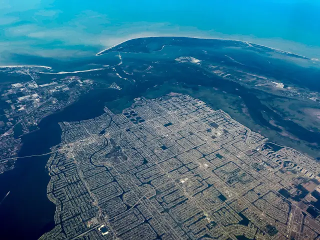
Fort Lauderdale is a Broward County city of approximately 36 square miles that the City of Fort Lauderdale calls the Venice of America (City of Fort Lauderdale).
The nickname rests on a number: the city counts 165 miles of inland waterways winding through Fort Lauderdale (City of Fort Lauderdale). Its flood office lists the water bodies that shape the map as the Atlantic Ocean, the Intracoastal Waterway, Middle River, the C-13 East and C-12 canals and the New River Canal (City of Fort Lauderdale flood page). Fort Lauderdale is the largest of Broward County's 31 municipalities, and county government is based in the city: the Broward County Governmental Center stands at 115 S. Andrews Ave., Fort Lauderdale, FL 33301, and the county help line is 311 (Broward County).
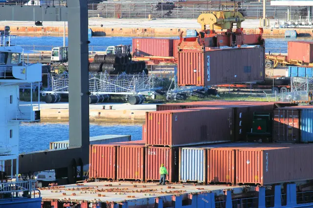
Two Broward County gateways serve Fort Lauderdale travelers. Fort Lauderdale-Hollywood International Airport is run by the Broward County Aviation Department at 100 Terminal Drive, Fort Lauderdale, FL 33315 (FLL). The airport warns that on peak cruise days, with several ships in South Florida ports, airlines at FLL may only check bags up to two hours before a scheduled flight (FLL). Port Everglades, which calls itself one of the busiest cruise ports in the world and a leading container port in Florida, is a self-supporting enterprise fund of Broward County government that does not rely on local tax dollars (Port Everglades).
Inside the city, the Fort Lauderdale guides break the map down further: the New River guide follows the river through downtown, the Las Olas Boulevard guide covers the main shopping street, and the Riverwalk guide covers the downtown waterfront promenade. The Fort Lauderdale airport guide (FLL) and the cruise tourism guide sit in the industries section.
How many people live in Fort Lauderdale, and who are they?
The U.S. Census Bureau's ACS 2020-2024 5-year estimate puts Fort Lauderdale at 185,604 residents, with a median age of 42.8 years (Census Bureau, DP05).
About 19.6 percent of Fort Lauderdale residents are 65 or older in the same 2020-2024 survey (DP05). Median household income is $83,130 in 2024 inflation-adjusted dollars (Census Bureau, DP03). The city holds 101,691 housing units, and the median value of an owner-occupied Fort Lauderdale home is $486,700 (Census Bureau, DP04).
The City of Fort Lauderdale's own About page gives an estimated population of 186,220 with no date attached (City of Fort Lauderdale); the Census figure above is the dated, comparable one. ACS 5-year numbers are averages across 2020 to 2024 and carry margins of error, so a single-year change in Broward County will not show up here right away.
| Measure | Fort Lauderdale estimate |
|---|---|
| Total population | 185,604 |
| Median age | 42.8 years |
| Residents 65 and over | 19.6 percent |
| Median household income | $83,130 (2024 dollars) |
| Housing units | 101,691 |
| Median value, owner-occupied home | $486,700 |
The Fort Lauderdale demographics section and the real estate guides (market trends, Victoria Park, Rio Vista, Coral Ridge and the Las Olas condo guide) carry the neighborhood detail behind these citywide numbers.
Who runs Fort Lauderdale and how is City Hall reached?
Fort Lauderdale has a Commission-Manager form of government: a five-member City Commission sets policy and appoints the City Manager, who holds administrative responsibility for the City (City of Fort Lauderdale City Commission).
The mayor of Fort Lauderdale is elected at-large and the four commissioners by district; each serves a four-year term and may serve three consecutive terms (City Commission). As listed on October 15, 2026, Mayor Dean J. Trantalis can be reached at 954-828-5314; John C. Herbst holds District 1, Steven Glassman District 2, Pamela Beasley-Pittman District 3, and Vice Mayor Ben Sorensen District 4 (City Commission).
Letters to the Fort Lauderdale mayor and commissioners go to City of Fort Lauderdale, 1 E. Broward Blvd. Suite 444, Fort Lauderdale, FL 33301, phone (954) 828-5003/5004 (City Commission). For flood, sewer or drainage problems or a clogged storm drain, the city routes residents to its 24-Hour Neighbor Service Center at 954-828-8000, and after a flood also to the FixIt FTL app (City of Fort Lauderdale).
The next regular Fort Lauderdale City Commission meetings are on Tuesday, October 20, 2026, at the Fort Lauderdale Police Department Community Room, 1300 W. Broward Boulevard, and vote summaries post on the city's Legistar calendar (LauderBriefs). Anyone heading to a Fort Lauderdale meeting should check the location posted on LauderBriefs before leaving. Last verified: October 15, 2026, on the City of Fort Lauderdale website.
The Fort Lauderdale government section has two deeper guides: the city commission members guide and the city officials guide.
What is there to do in Fort Lauderdale?
Fort Lauderdale's own short list of things to do starts downtown, with the Riverwalk district and its museums and theater and Las Olas Boulevard (City of Fort Lauderdale).
The City of Fort Lauderdale calls the Riverwalk the cornerstone of its arts, science, cultural and historic district, home to the Broward Center for the Performing Arts, the Museum of Discovery and Science, the Museum of Art and Old Fort Lauderdale Village and Museum (City of Fort Lauderdale). The same page names Las Olas Boulevard as the city's centerpiece of fashion, fine dining and entertainment, and lists Broward College, Florida Atlantic University and the Broward County Main Library downtown.
Hugh Taylor Birch State Park opens 8 a.m. to sunset, 365 days a year (Florida State Parks). Entry is $6 per vehicle with up to eight people, $4 for a single-occupant vehicle or motorcycle and $2 for pedestrians and bicyclists (Florida State Parks). Port Everglades held its official dedication ceremony on February 22, 1928, and welcomed its first official cruise line in the 1930s (Port Everglades).
Ten Fort Lauderdale landmark guides go deeper: Bonnet House Museum and Gardens, Butterfly World, Hugh Taylor Birch State Park, the International Swimming Hall of Fame, Las Olas Boulevard, the New River, the NSU Art Museum, the Riverwalk, Sawgrass Mills and the Stranahan House. The Fort Lauderdale history guides cover the 1838 Seminole War fort, the Frank Stranahan trading post, the city's founding and the 1960s spring break era.
What is changing in Fort Lauderdale right now?
Fort Lauderdale's stormwater program, Fortify Lauderdale, commits up to $500 million to stormwater and flood prevention systems across 17 neighborhoods (Office of the Mayor).
Fortify Lauderdale builds on an earlier program that set aside $200 million for flooding in the seven most vulnerable Fort Lauderdale neighborhoods; the mayor's office also lists the River Oaks stormwater preserve, drainage work in Edgewood, Melrose Manors and Riverland, new seawalls on the Isles and in Rio Vista, and groundbreaking on a new water treatment plant (Office of the Mayor). That page is a record of the mayor's office, so the dollar totals are the city's own claims, not audited spending.
The October 6, 2026 Fort Lauderdale Commission meetings show what comes next (LauderBriefs). The A-7 sewer basin downtown has reached capacity, so the city plans a new A-5 Sanitary Sewer Lift Station with an allocated budget of $11.5 million and preliminary design finished. The South Regional Activity Center Vision Plan covers the area from the Tarpon River south to State Road 84, between the FEC tracks and US-1, and will guide a second phase with a comprehensive master plan and updated development rules. A proposed e-bike and micromobility ordinance would require registration with the City and restrict use in City parks; city staff will refine the ordinance with the Commission's feedback before it returns.
Fort Lauderdale is moving forward with $5.5 million in safety improvements at six railroad crossings, with the City paying about $676,000, and must tell the Federal Railroad Administration its Quiet Zone decision by November 1, 2026 (LauderBriefs). The same meeting approved about $6.9 million for the water and wastewater system, which runs three water treatment facilities, a regional wastewater treatment facility and 186 sanitary sewer pump stations serving approximately 250,000 neighbors and guests.
The Fort Lauderdale water service guide explains the utility side, and the economy section's major employers guide covers who is hiring behind the downtown growth.
How exposed is Fort Lauderdale to flooding and hurricanes?
Flood exposure is the defining Fort Lauderdale risk: the city says a majority of its residents live in or close to a FEMA Special Flood Hazard Area (City of Fort Lauderdale).
Fort Lauderdale property owners can look up a flood zone on the Broward FEMA Flood Map or by calling the city at 954-828-6133; the current FEMA flood insurance rate maps took effect August 18, 2014 (City of Fort Lauderdale). Most homeowner policies in Fort Lauderdale do not cover flooding, and National Flood Insurance Program coverage starts only after a 30-day waiting period, so a policy bought when a storm is in the forecast will not cover it. Because Fort Lauderdale takes part in the Community Rating System, residents currently get a 20 percent discount on flood insurance premiums (City of Fort Lauderdale).
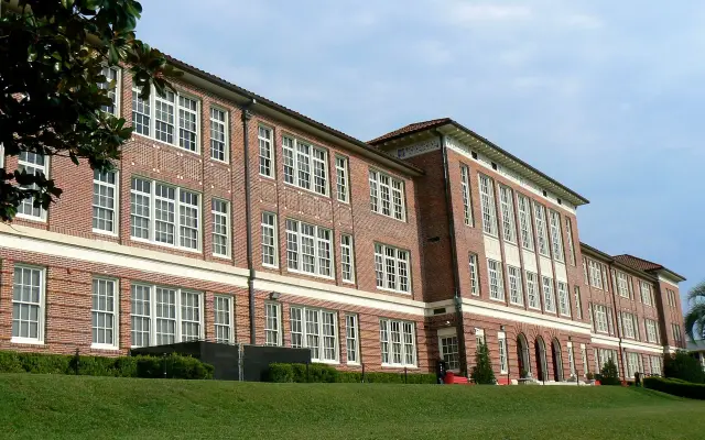
Hurricane season runs June 1 to November 30, per the same Fort Lauderdale page, which still describes 2018 as a mild season and cites Hurricane Irma in September 2017, so its storm history is out of date (City of Fort Lauderdale). Broward County's hurricane site lists Arthur Ashe/Rock Island (Atlantic Technical College) in Fort Lauderdale among its shelter sites and posts an open or closed status for each site (Broward County).
The Fort Lauderdale safety guides cover flood risk zones, hurricane evacuation zones and sinkhole risk areas, and the weather guides cover the hurricane season, seasonal patterns and the city's historical storm impacts.
Which Fort Lauderdale guide answers which question?
Each common Fort Lauderdale question has a Digital Towns guide that answers it in depth, and the table below pairs the question with the key fact and that guide.
| Question | Key fact | Fort Lauderdale guide |
|---|---|---|
| Who sits on the City Commission? | Mayor Dean J. Trantalis and four district commissioners | City commission members; city officials |
| Is my address in a flood zone? | Broward FEMA Flood Map or 954-828-6133; maps dated August 18, 2014 | Flood risk zones |
| Do I have to evacuate? | Broward County lists shelters and zones on its hurricane site | Hurricane evacuation zones; hurricane season guide |
| Where does tap water come from? | Three city water treatment facilities | Water service |
| Which public schools serve the city? | District-run public schools serving the city | Public schools |
| Where do people live and what do homes cost? | Median owner home value $486,700 (ACS 2020-2024) | Market trends; Victoria Park; Rio Vista; Coral Ridge; Las Olas condos |
| What drives the local economy? | Marine, finance, tourism, aviation and the port | Major employers; marine and yachting; cruise tourism; finance and wealth; healthcare in Broward |
| How did the city begin? | Named for an 1838 Seminole War fort on the New River | Founding; Seminole War fort 1838; Frank Stranahan trading post |
The Fort Lauderdale history guides start from the city's own account: the name comes from a Second Seminole War fortification built on the banks of the New River in 1838, one of three forts named for Major William Lauderdale, none of which survive (City of Fort Lauderdale). The city was incorporated on March 27, 1911.
Frequently asked questions
What county is Fort Lauderdale in?
Fort Lauderdale is in Broward County, and the Broward County Governmental Center sits in the city at 115 S. Andrews Ave. The city says Fort Lauderdale is the largest of the county's 31 municipalities, covering about 36 square miles.
What is the population of Fort Lauderdale?
The U.S. Census Bureau's ACS 2020-2024 5-year estimate is 185,604 residents, with a median age of 42.8. The City of Fort Lauderdale's own About page gives an undated estimate of 186,220.
Who is the mayor of Fort Lauderdale?
Dean J. Trantalis is mayor as of October 15, 2026, elected at-large to a four-year term. His office line is 954-828-5314. Ben Sorensen, the District 4 commissioner, is vice mayor.
Where do Fort Lauderdale City Commission meetings take place?
The next regular meetings, on Tuesday, October 20, 2026, are in the Fort Lauderdale Police Department Community Room at 1300 W. Broward Boulevard. Agendas and vote summaries are posted on the city's Legistar calendar.
Why is Fort Lauderdale called the Venice of America?
The City of Fort Lauderdale says 165 miles of inland waterways wind through the city, and it uses the Venice of America name for that network. The city flood office lists the New River Canal, Middle River and the Intracoastal Waterway among its main water bodies.
Sources
- City of Fort Lauderdale City Commission https://www.fortlauderdale.gov/government/city-commission Used for: Commission-Manager government, five members, terms, officeholders, phone numbers, correspondence address
- City of Fort Lauderdale, About Fort Lauderdale https://www.fortlauderdale.gov/government/about-fort-lauderdale Used for: incorporation date, 36 square miles, city population estimate, 31 Broward municipalities, 165 miles of waterways, Riverwalk and Las Olas, 1838 fort
- City of Fort Lauderdale, Office of the Mayor, Infrastructure https://www.fortlauderdale.gov/government/city-commission/mayor-dean-j-trantalis/infrastructure Used for: Fortify Lauderdale $500 million across 17 neighborhoods, earlier $200 million program, pipe miles, River Oaks stormwater preserve
- City of Fort Lauderdale, Flood and Flood Insurance https://www.fortlauderdale.gov/government/departments-a-h/fire-rescue/emergency-services/emergency-management-homeland-security-domestic-preparedness/flood-and-flood-insurance Used for: Special Flood Hazard Area, waterways, FIRM date, floodplain phone, 30-day NFIP wait, CRS discount, hurricane season dates
- City of Fort Lauderdale, LauderBriefs (October 6, 2026 meetings) https://www.fortlauderdale.gov/Government/City-Commission-Meetings/LauderBriefs Used for: meeting location, A-5 lift station, SRAC Vision Plan, e-bike rules, Quiet Zone, utility system figures
- Broward County Official Hurricane Site, Evacuations https://www.broward.org/hurricane/pages/evacuations.aspx Used for: Broward County Governmental Center address, 311, Arthur Ashe/Rock Island shelter in Fort Lauderdale
- Port Everglades, About Us https://www.porteverglades.net/about-us/ Used for: Broward County enterprise fund, cruise and container port, 1928 dedication
- Fort Lauderdale-Hollywood International Airport (Broward County Aviation Department) https://www.fll.net/about Used for: airport operator and address, cruise-day bag check advisory
- Florida State Parks, Hugh Taylor Birch State Park Hours and Fees https://www.floridastateparks.org/parks-and-trails/hugh-taylor-birch-state-park/hours-fees Used for: hours and entrance fees
- U.S. Census Bureau, ACS 2020-2024 5-year Data Profile DP05, Fort Lauderdale city https://data.census.gov/api/access/data/table?id=ACSDP5Y2024.DP05&g=160XX00US1224000 Used for: population, median age, share 65 and over
- U.S. Census Bureau, ACS 2020-2024 5-year Data Profile DP03, Fort Lauderdale city https://data.census.gov/api/access/data/table?id=ACSDP5Y2024.DP03&g=160XX00US1224000 Used for: median household income
- U.S. Census Bureau, ACS 2020-2024 5-year Data Profile DP04, Fort Lauderdale city https://data.census.gov/api/access/data/table?id=ACSDP5Y2024.DP04&g=160XX00US1224000 Used for: housing units and median home value
How this page was made
Digital Towns uses AI assistance to research and write its guides, and every page is only as good as the sources it cites. Our goal is the most accurate, useful local information possible.
This page was fact-checked twice before publishing.
If you see an error, or anything you can show is false, tell us right away and we will take a third look.
Report an error
Thank you. We'll take a third look and correct the page if it's wrong.

