Short answer: Tampa Heights is one of Tampa's oldest residential neighborhoods, immediately north of downtown. Its first subdivision, Orange Grove Estates, dates to the 1870s, and by about 1910 a Tampa Heights address was among the most fashionable in the city. The 200-acre core was listed as a National Register district in 1995, and the city now steers redevelopment through the Tampa Heights Riverfront CRA.
Last verified: October 18, 2026, against the sources listed at the end of this page.
Where is Tampa Heights in Tampa?
Tampa Heights is the neighborhood immediately north of downtown Tampa, bounded roughly by Martin Luther King Jr. Boulevard, North Boulevard and Interstate 275.
The City of Tampa neighborhood page gives its boundaries as roughly E. MLK Jr. Boulevard to the north, N. Boulevard to the west, I-275 and the Hillsborough River to the south, and I-275 to the east, and lists ZIP Codes 33602, 33603, 33605 and 33607. The city names the Hillsborough County Public Schools located in the neighborhood: the Adult Education Center, Anderson Elementary Academy, Blake High, Brewster Technical Adult, D W Waters Career Center High, Graham Elementary and Lee Elementary.
The National Register district is a smaller core. The 1995 Tampa Heights Historic District nomination places it immediately north of downtown Tampa and west of Interstate 275, bounded by Adalee Street on the north, I-275 on the east, 7th Avenue on the south and North Tampa Avenue on the west, about five blocks wide and nineteen blocks long, with Columbus Drive and Palm Avenue as its main east-west corridors.
How did Tampa Heights begin?
Tampa Heights began in the 1870s with Orange Grove Estates, carved from the homestead of Joseph Robles, and by 1900 a patchwork of subdivisions carried the Tampa Heights name.
The National Register nomination records that the first subdivision in Tampa Heights was Orange Grove Estates, created in the 1870s from the old homestead of Joseph Robles, who settled in the Tampa area in 1857, on land north of Columbus Drive between Florida and Nebraska Avenues. More than a decade passed before the next subdivisions: one was recorded in 1889 and Bonniehurst Subdivision followed in 1890, and 21 new subdivisions were platted in the area between 1901 and 1907. That piecemeal growth, the form explains, is why Tampa Heights streets jog and its blocks vary in size and orientation.
By 1900 the patchwork neighborhood had acquired the title of Tampa Heights. The nomination says city directories and Sanborn maps from 1890 to 1910 show the suburb developing rapidly as home to many of Tampa's important businessmen and prominent citizens, convenient to Ybor City and downtown, and that its distance from the marshy, low-lying parts of Tampa was thought to protect residents from the yellow fever epidemics that struck the city each year in the 19th century. Many early Queen Anne and turn of the century houses were originally country homes associated with small orange groves outside the city limits.
What did Tampa Heights look like at its peak?
Around 1910 a Tampa Heights address was among the most fashionable in Tampa, with large two-story Queen Anne frame houses in the southern part of the neighborhood.
The nomination dates the crest of the neighborhood's reputation to about 1910. About that time, it says, wealthier Tampa residents began building in Hyde Park west of the Hillsborough River, and by 1915 a significant number of bungalows began to appear in Tampa Heights. As construction moved north from 7th Avenue, the neighborhood became more middle class and ethnically mixed, while the older Victorian area near downtown declined as residents left for newer subdivisions across the river.
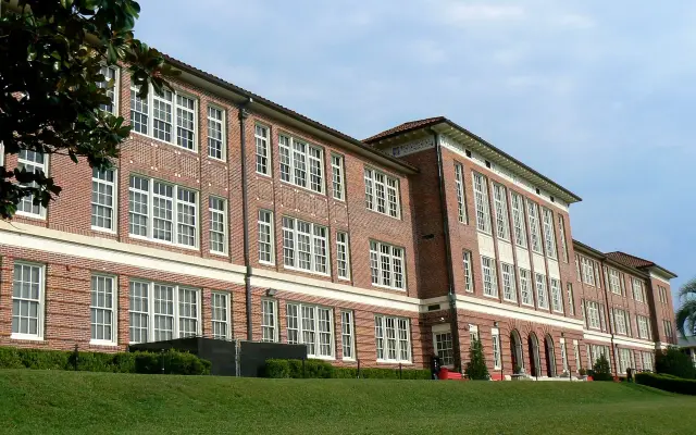
The 1920s boom still added public buildings. The nomination names the Episcopal House of Prayer at 2708 N. Central Avenue, listed in the National Register in 1991, the Tampa Heights Presbyterian Church and the Palm Avenue Baptist Church among 1920s religious buildings; the Classical Revival style Robert E. Lee Elementary School at 305 E. Columbus Drive, serving Tampa Heights children since 1906; and the Mediterranean Revival style Fire Station No. 5 at 1910 N. Florida Avenue, erected in 1926 and, at the time of the 1995 nomination, still used by the Tampa Fire Department.
Soldiers passed through as well. The 2012 National Register form for the Palmetto Beach Historic District records that Spanish-American War troops in 1898 camped in tent cities at Port Tampa, Tampa Heights, Fort Brooke, DeSoto Park, Palmetto Beach and Lakeland.
What does the Tampa Heights Historic District include?
The Tampa Heights Historic District covers about 200 acres and 427 buildings, of which 289 contribute to its historic character, according to the 1995 National Register nomination.
| Detail | National Register record |
|---|---|
| NRIS ID | 95000979 |
| NPS record date | 8/4/1995 |
| Area | Approximately 200 acres |
| Buildings | 427: 289 contributing (68 percent), 138 noncontributing (32 percent) |
| Dates of historic buildings | About 1890 to 1945 |
| Periods of significance (NPS record) | 1875 to 1899, 1900 to 1924, 1925 to 1949 |
Sources: nomination form and NPGallery record, National Park Service. The nomination says most houses in Tampa Heights are bungalows or wood frame vernacular residences built between about 1910 and 1925, alongside Colonial Revival, Queen Anne, Tudor Revival and Mediterranean Revival examples, and that the district also holds several churches, a school, a fire station and a handful of commercial buildings, mostly along Florida and Tampa avenues. The two NPS documents date the district differently: the form gives historic buildings from about 1890, while the NPGallery record lists a period of significance starting in 1875.
The City of Tampa also regulates Tampa Heights locally. Its Historic District Maps page lists Tampa Heights among the Local Historic District Maps, which include national boundaries, with Hyde Park, Seminole Heights and Ybor City, and says staff use the maps together with master site files to help determine whether a structure is contributing or non-contributing.
Why did Tampa Heights decline in the twentieth century?
Tampa Heights declined as the cigar industry faded in the 1930s and newer suburbs opened after World War II, according to its National Register nomination.
The nomination explains that by the beginning of the 1930s Tampa's cigar industry was already declining, as Americans turned to cigarettes and machines produced high quality cigars, throwing thousands of cigarmakers out of work. Housing construction fell across Tampa's residential areas and the city began to lose population. The deterioration of Tampa Heights accelerated after World War II, as more modern suburbs opened in the northwestern Carrollwood area and on the Interbay peninsula.
The form also describes the earlier shift within the neighborhood. Once wealthier residents moved west of the Hillsborough River, most new Tampa Heights homes were one-story bungalows with little ornamentation, and even larger houses tended to be vernacular versions of the Colonial Revival style. The St. Joseph's Hospital building that once stood at 301 E. 7th Avenue was demolished when the hospital relocated to Buffalo Avenue.
How is Tampa Heights being redeveloped?
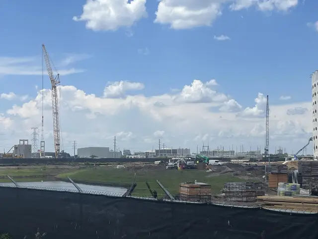
Redevelopment in Tampa Heights runs through the Tampa Heights Riverfront Community Redevelopment Area, created after the Tampa Police Department left its old headquarters site in 1997.
The City of Tampa CRA history records that in 1997 the Tampa Police Department relocated its headquarters from the corner of Tampa and Henderson Streets to Franklin Street downtown, leaving an antiquated building and a large empty parking lot. The city created the Old Tampa Police Department Site Community Redevelopment Area and adopted a long-term CRA plan in 1999, and the construction of the Stetson University Law School on the former headquarters grounds was one of the first major milestones. The Tampa Heights Riverfront CRA page, updated February 24, 2026, lists a Tampa Heights CRA Plan Update with a community meeting survey.
On the river, Water Works Park at 1710 N Highland Ave. is a City of Tampa park open from 7 am to 10 pm with no admission fee. The Parks and Recreation page (updated February 27, 2026) lists open green space, Queenie's Dog Park, covered and shaded picnic areas, a playground, a splash pad, an amphitheater and a boat dock that serves as a water taxi stop with views of downtown and the Tampa Riverwalk.
Utility work is the largest share of current city spending listed for the neighborhood. The Tampa Heights neighborhood page shows these capital projects, all in Council District 5 and funded through PIPES:
| Project | Estimated cost |
|---|---|
| The Heights WM Improvement Project, Florida Ave from Palm Ave to Dr MLK Jr Blvd (Phase II) | $4,534,148 |
| Jefferson water main replacement | $2,557,137 |
| Floribraska water main replacement | $1,794,339 |
| East/West Columbus Drive water mains | $1,438,509 |
| The Heights WM Improvement Project, Florida Ave from Scott St to Palm Ave (Phase I) | $1,248,239 |
| Adalee Pumping Station Rehabilitation | $1,046,500 |
| JPA, FDOT Heights Multimodal Improvements (gravity main relocation) | $1,000,000 |
Source: City of Tampa, Tampa Heights neighborhood page, capital projects list read October 18, 2026.
Last verified: October 18, 2026, by re-reading the Tampa Heights Historic District nomination and NPGallery record, the Palmetto Beach National Register form, and five City of Tampa pages: the Tampa Heights neighborhood profile, the CRA history and CRA home page, Water Works Park and the historic district maps.
Frequently asked questions
What was the first subdivision in Tampa Heights?
The National Register nomination says it was Orange Grove Estates, created in the 1870s from the homestead of Joseph Robles, north of Columbus Drive between Florida and Nebraska avenues.
Is Tampa Heights a historic district?
Yes. The National Park Service lists the Tampa Heights Historic District (NRIS 95000979), about 200 acres with 289 contributing buildings, and the City of Tampa maps Tampa Heights as a local historic district.
Why was Tampa Heights popular in the 1890s?
The nomination says it was convenient to Ybor City and downtown, and its distance from low-lying parts of Tampa was thought to protect residents from the yellow fever epidemics that struck the city each year.
Is Water Works Park open to the public?
Yes. The City of Tampa lists Water Works Park at 1710 N Highland Ave. as a public city park with no admission fee, open 7 am to 10 pm, with a dog park, splash pad, picnic areas and a water taxi stop.
What is the Tampa Heights Riverfront CRA?
It is the City of Tampa redevelopment district that began as the Old Tampa Police Department Site CRA, with a long-term plan adopted in 1999 after police headquarters moved downtown in 1997.
Sources
- Tampa Heights, City of Tampa neighborhoods https://www.tampa.gov/neighborhoods/tampa-heights Used for: boundaries, ZIP codes, schools, capital projects
- Tampa Heights Historic District, National Register nomination form, National Park Service https://npgallery.nps.gov/GetAsset/5de2afaa-568d-4e37-a512-a95b40b66e0f Used for: boundaries, subdivisions, 1910 peak, landmarks, resource counts, decline
- Tampa Heights Historic District (NRIS 95000979), NPGallery, National Park Service https://npgallery.nps.gov/AssetDetail/NRIS/95000979 Used for: NRIS ID, record date, periods
- Tampa Heights Riverfront History, City of Tampa CRA https://www.tampa.gov/CRAs/tampa-heights/history Used for: 1997 police move, 1999 CRA plan, Stetson law school
- Tampa Heights Riverfront CRA, City of Tampa https://www.tampa.gov/cras/tampa-heights-riverfront Used for: CRA plan update survey, page date
- Water Works Park, City of Tampa Parks and Recreation https://www.tampa.gov/parks-and-recreation/featured-parks/waterworks Used for: address, hours, features, no admission fee
- Historic District Maps, City of Tampa https://www.tampa.gov/historic-preservation/info/district-maps Used for: Tampa Heights local district map
- Palmetto Beach Historic District, National Register registration form, National Park Service https://npgallery.nps.gov/GetAsset/9e8ddb03-894f-4479-9a45-16d7daed8719 Used for: 1898 tent cities at Tampa Heights
How this page was made
Digital Towns uses AI assistance to research and write its guides, and every page is only as good as the sources it cites. Our goal is the most accurate, useful local information possible.
This page was fact-checked twice before publishing.
If you see an error, or anything you can show is false, tell us right away and we will take a third look.
Report an error
Thank you. We'll take a third look and correct the page if it's wrong.