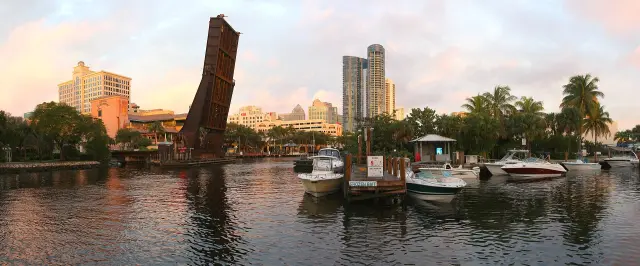
Short answer: Fort Lauderdale is named for Major William Lauderdale, whose Second Seminole War fort went up on the banks of the New River in 1838. The first train to Miami reached the settlement on February 22, 1896, and the city incorporated on March 27, 1911. History Fort Lauderdale at 231 SW 2nd Ave. is open daily from 10 a.m. to 4 p.m., and the city counts three historic districts and 62 landmark sites.
Last verified: October 16, 2026, against the sources listed at the end of this page.
How did Fort Lauderdale get its name?
Fort Lauderdale takes its name from Second Seminole War forts on the New River, the first built in 1838 and named for Major William Lauderdale (City of Fort Lauderdale).
Major Lauderdale led a detachment of Tennessee Volunteers south along the east coast of Florida in 1838, and three posts carried his name: the first at the fork of the New River, the second at Tarpon Bend and the largest on the beach where Bahia Mar sits today (City of Fort Lauderdale). None of the three forts survive (City of Fort Lauderdale).
The state marker record fills in the dates. Soldiers camped on the north bank of the New River at its forks on March 6, 1838, and the garrison had left by May 1838 (Florida Department of State). A second Fort Lauderdale went up in February 1839 on the north bank at about what is now Southeast Ninth Avenue, and the third, on the strip of land between the Atlantic Ocean and New River Sound, was finished by September 1839 (Florida Department of State). The Indian Haulover marker at the Bahia Mar entrance gives a different date: it says a fort named for Major Lauderdale was built near there in 1838 and stayed active until the war ended in 1842 (Florida Historical Markers).
The markers stand where the history happened: The First Fort Lauderdale marker at 400 SW 11th Avenue and The Second Fort Lauderdale marker at 630 SW 9th Avenue (Florida Department of State). The Fort Lauderdale original 1838 fort guide covers the three posts in depth.
Who lived on the New River before the Fort Lauderdale forts?
Long before the 1838 fort, the Tequesta camped in what is now Sailboat Bend as early as 500 BCE, and by 1800 Seminole, Bahamian and American settlers lived along the New River (Florida Department of State).
The First Fort Lauderdale marker says Major General Thomas Jesup sent 200 mounted Tennessee Volunteers under Major Lauderdale from Jupiter to the New River, along a route later known as Military Trail (Florida Historical Markers). On the beach, Bahia Mar is the site of a haulover where Indians took their canoes from New River Sound into the Atlantic Ocean (Florida Department of State). Seminole life on the river went on after the forts: Seminole matriarch Annie Jumper Tommie and her family set up a Panther clan camp about 1902 on the north fork of the New River, the last permanent Seminole camp in the City of Fort Lauderdale, and its marker stands at 101 NW 15 Ave (Florida Historical Markers). The New River guide in the Fort Lauderdale landmarks section follows the river itself from that era to the downtown waterfront.
When did the railroad come to Fort Lauderdale and when did the city incorporate?
The first train to Miami reached Fort Lauderdale on February 22, 1896, and the City of Fort Lauderdale was incorporated fifteen years later, on March 27, 1911 (Florida Department of State; City of Fort Lauderdale).
Florida East Coast Railway owner Henry Flagler asked Philemon Bryan to build the railway section from the New River to Pompano, and in 1894 Bryan and his sons Tom and Reed brought 400 African-American workers by boat from New Smyrna to build the roadbed (Florida Department of State). The Bryans then bought land on both sides of the tracks in what became downtown Fort Lauderdale, and in 1905 contractor Edwin T. King built the New River Inn and the Bryan houses, the first residential neighborhood in the city (Florida Historical Markers).
Today the city covers about 36 square miles and is the largest of the 31 municipalities in Broward County (City of Fort Lauderdale). The pioneer era guide in the Fort Lauderdale history section covers the path from railroad stop to incorporated city; the marine and yachting guide in the industries section picks up the boatbuilding story that followed.
Who built the Stranahan House and why does it matter to Fort Lauderdale?
The Stranahans built the Stranahan House on SE 6th Avenue, and the state marker at Evergreen Cemetery counts them among the founding families of Fort Lauderdale (Florida Department of State).
Another state marker calls Ivy Stranahan Fort Lauderdale's first school teacher and says Frank and Ivy Stranahan donated the land for the original Fort Lauderdale High School, dedicated on September 16, 1915 as the first high school in newly organized Broward County (Florida Historical Markers). The Annie Tommie's Camp marker says the pioneer Ivy Stranahan convinced Annie Tommie and her family to move to the new federal Indian reservation west of Dania, now Hollywood (Florida Department of State). The City of Fort Lauderdale rezoned the Stranahan House and property as an H-1 historic district in 1982 to protect the area from development (City of Fort Lauderdale). Ivy Julia Stranahan, born a Cromartie, lived from 1881 to 1971, and the Stranahans rest in Evergreen Cemetery at 1300 SE 10th Ave., established by Mr. and Mrs. E.T. King in 1910 and the oldest intact cemetery in Fort Lauderdale (Florida Historical Markers).
The house is now the Historic Stranahan House Museum at 335 SE 6th Avenue, phone 954-524-4736, with tour tickets from $13 and final tours accepted at 3:15 p.m. on open days (Historic Stranahan House Museum). It opens five to six days a week for tours and its availability changes weekly due to field trips, private tours and venue rentals, so the museum suggests booking tickets in advance; parking is limited, and the museum points drivers to the Riverside Hotel at 620 E Las Olas Blvd. for GPS and parking, a short walk from the gate (Historic Stranahan House Museum). The Frank Stranahan trading post guide covers the trading years, and the Stranahan House guide in the landmarks section covers the visit.
What were the 1961 Fort Lauderdale beach wade-ins?
The Fort Lauderdale beach wade-ins were civil rights protests against whites-only public beaches that began on July 4, 1961, led by local NAACP president Eula Johnson and physician Von Mizell (Florida Department of State).
As many as 200 African-American residents took part in later wade-ins during July and August 1961 (Florida Historical Markers). The City of Fort Lauderdale went to Broward County Circuit Court on August 12, 1961, to stop them, and on July 11, 1962, Judge Ted Cabot denied the request, a decision that effectively desegregated the county's beaches (Florida Department of State). The marker stands at S. Fort Lauderdale Blvd. at E. Las Olas Blvd.(Florida Historical Markers).
The state record is not consistent on one date: the John U. Lloyd State Park marker at 6503 N. Ocean Dr. says the City of Fort Lauderdale requested an injunction to end the wade-ins in July 1962 and that the court ruled in favor of the defendants, while the wade-ins marker dates the city's suit to August 12, 1961 and the ruling to July 11, 1962 (Florida Department of State). The Lloyd marker adds that in 1954 the county acquired a barrier island site designated for segregation and promised to make it accessible, but a road was never built (Florida Historical Markers).
Where can Fort Lauderdale history be seen in person?
The best single stop is History Fort Lauderdale at 231 SW 2nd Ave., open seven days a week from 10 a.m. to 4 p.m. (History Fort Lauderdale).
History Fort Lauderdale gives docent guided tours daily at 1, 2 and 3 p.m., offers walking tours on special request, answers at 954-463-4431 and admits individuals and families with a SNAP EBT card and photo ID free (History Fort Lauderdale). Old Fort Lauderdale Village, on SW 2nd St. at the intersection of the New River and the Florida East Coast Railway takes in four buildings: the 1905 New River Inn, the 1905 Philemon N. Bryan House, the 1905 Acetylene Building and the 1907 King-Cromartie House, with the New River Inn on the National Register of Historic Places (Florida Department of State).
Citywide, Fort Lauderdale counts three historic districts, 62 individually designated landmark sites and fifteen National Register sites (City of Fort Lauderdale). Sailboat Bend is the largest district at more than 550 buildings, and its Swing Bridge, West Side Fire Station and West Side School are also local landmarks; Himmarshee, the oldest section of the commercial downtown, holds about 17 properties, including the Fort Lauderdale Historical Society in the Hoch Heritage Center, the Philemon Bryan House, the King-Cromartie House and the restored New River Inn, and a replica of the first Fort Lauderdale schoolhouse stands in the district (City of Fort Lauderdale). Any alteration, addition or new building on a designated Fort Lauderdale landmark needs a Certificate of Appropriateness from the Historic Preservation Board, and questions go to the Urban Design and Planning Division at (954) 828-7101 (Historic Preservation). Last verified: October 15, 2026, on the City of Fort Lauderdale historic preservation pages and the Florida Department of State marker list.
Which Fort Lauderdale history guide answers which question?
Three guides sit in the Fort Lauderdale history section, and two more in the landmarks and industries sections carry the river and boatbuilding story.
| Question about Fort Lauderdale history | Key fact | Guide |
|---|---|---|
| Where was the 1838 fort? | North bank of the New River at its forks, March 6, 1838 | original 1838 fort guide |
| Who was Frank Stranahan? | Built the Stranahan House on SE 6th Avenue with his wife Ivy | Frank Stranahan trading post guide |
| When did Fort Lauderdale become a city? | Incorporated March 27, 1911; train arrived February 22, 1896 | Pioneer era guide |
| Why does the New River matter? | Tequesta camps as early as 500 BCE in Sailboat Bend | New River guide (landmarks) |
| How did boatbuilding grow? | Covered in the industries section | Marine and yachting guide (industries) |
Frequently asked questions
Who is Fort Lauderdale named after?
Fort Lauderdale is named for Major William Lauderdale, who led 200 mounted Tennessee Volunteers from Jupiter to the New River in 1838 during the Second Seminole War. Three forts carried his name, at the fork of the New River, at Tarpon Bend and on the beach at Bahia Mar, and none survive.
Who built the Stranahan House in Fort Lauderdale?
The Stranahans built the Stranahan House on SE 6th Avenue, and a state marker names them among the founding families of Fort Lauderdale. The house is now the Historic Stranahan House Museum at 335 SE 6th Avenue, with tour tickets from $13 and final tours at 3:15 p.m. on open days.
When was Fort Lauderdale incorporated?
The City of Fort Lauderdale was incorporated on March 27, 1911, fifteen years after the first train to Miami reached the New River settlement on February 22, 1896. The city now covers about 36 square miles in Broward County.
Is History Fort Lauderdale free?
History Fort Lauderdale at 231 SW 2nd Ave. sells admission, with docent tours daily at 1, 2 and 3 p.m. Admission is free for individuals and families who present a SNAP EBT card and a valid photo ID.
What is the oldest neighborhood in Fort Lauderdale?
The City of Fort Lauderdale calls the Sailboat Bend Historic District the oldest neighborhood in the city, with homes from the early 1900s to the 1950s. State markers place Tequesta camps in the Sailboat Bend area as early as 500 BCE.
Sources
- City of Fort Lauderdale, About Fort Lauderdale https://www.fortlauderdale.gov/government/about-fort-lauderdale Used for: 1838 fort and namesake, three fort sites, incorporation date, area, 31 municipalities
- City of Fort Lauderdale, Historic Districts https://www.fortlauderdale.gov/Government/Departments/Development-Services/Urban-Design-and-Planning/Historic-Preservation/Historic-Districts Used for: three districts, Sailboat Bend, Himmarshee properties, Stranahan House H-1 1982
- City of Fort Lauderdale, Historic Preservation https://www.fortlauderdale.gov/Government/Departments/Development-Services/Urban-Design-and-Planning/Historic-Preservation Used for: 62 landmarks, 15 National Register sites, Certificate of Appropriateness, contact phone
- Florida Department of State, Florida Historical Markers, Broward County https://apps.flheritage.com/markers/markers.cfm?county=broward Used for: Tequesta, forts, railroad, New River Inn, Old Fort Lauderdale Village, Evergreen Cemetery, wade-ins
- Historic Stranahan House Museum https://www.stranahanhouse.org/ Used for: 1901 house, oldest surviving structure, address, phone, tour price and last tour
- History Fort Lauderdale https://www.historyfortlauderdale.org/ Used for: address, phone, hours, docent tours, since 1962, free SNAP EBT admission, planned museum
How this page was made
Digital Towns uses AI assistance to research and write its guides, and every page is only as good as the sources it cites. Our goal is the most accurate, useful local information possible.
This page was fact-checked twice before publishing.
If you see an error, or anything you can show is false, tell us right away and we will take a third look.
Report an error
Thank you. We'll take a third look and correct the page if it's wrong.