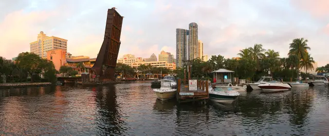
Short answer: Fort Lauderdale is mapped on FEMA's July 31, 2024 FIRM, and zones vary block by block: VE on the beach (base flood elevation 11 feet), AE at 6 feet downtown along the New River, X at barrier island street points, and AH inland. The city is a Community Rating System Class 7, worth 15 percent off NFIP premiums in high risk zones. Zones can be checked free on the city GIS map or by calling the Floodplain Group at 954-828-6520.
Last verified: October 18, 2026, against the sources listed at the end of this page.
What do the flood zone letters on a Fort Lauderdale map mean?
Fort Lauderdale flood maps use X for low and moderate risk, AE, AO and AH for inland high risk, and VE for the coastal strip exposed to wave action (City of Fort Lauderdale, Flood Risk Information).
The dividing line is a 1 percent yearly chance: any place with a 1% chance or higher of flooding each year counts as high risk on the Fort Lauderdale FIRM (City of Fort Lauderdale). Those high risk zones are the Special Flood Hazard Areas, which the Development Services CRS page lists as Zones AE, AO, AH and VE (City of Fort Lauderdale CRS page). Being outside one is not a guarantee: the same page warns that properties outside a Special Flood Hazard Area are not guaranteed to be safe from flooding.
The zones change within a few blocks, which is why a citywide answer is never enough. FEMA National Flood Hazard Layer queries run on October 18, 2026 at sample points across Fort Lauderdale returned four different zone letters. Street points come from the Census Geocoder for each public address, for example 400 SW 2nd St and 6000 NW 21st Ave. Base flood elevations are in feet above the NAVD88 datum.
| Sample point | Zone | Base flood elevation | Source |
|---|---|---|---|
| Beach sand east of 3000 E Las Olas Blvd (26.1185 N, 80.1036 W) | VE, coastal floodplain | 11.0 feet | FEMA NFHL |
| Street point, 3000 E Las Olas Blvd, barrier island | X, area of minimal flood hazard | None (query returns -9999) | FEMA NFHL |
| Street point, 3109 E Sunrise Blvd | X, area of minimal flood hazard | None (query returns -9999) | FEMA NFHL |
| Street point, 400 SW 2nd St, north bank of the New River | AE, coastal floodplain | 6.0 feet | FEMA NFHL |
| Street point, 100 N Andrews Ave, downtown | AE, coastal floodplain | 6.0 feet | FEMA NFHL |
| Street point, 1150 G Harold Martin Dr | AE, coastal floodplain | 6.0 feet | FEMA NFHL |
| Street point, 6000 NW 21st Ave, northwest Fort Lauderdale | AH | 12.0 feet | FEMA NFHL |
Two readings stand out. On the barrier island, the VE zone on the beach gives way to Zone X at the Las Olas street point a short distance west, so two nearby Fort Lauderdale lots can fall on opposite sides of the Special Flood Hazard Area line. Inland, the AH zone at the NW 21st Ave point carries a higher base flood elevation (12.0 feet) than the downtown AE points (6.0 feet). The Fire Rescue flood page defines Zone AH as one percent annual chance shallow flooding, usually areas of ponding, with average depths between 1 and 3 feet, and Zone VE as coastal floodplain with added storm wave hazards (City of Fort Lauderdale Fire Rescue).
Which FEMA flood map is in effect for Fort Lauderdale in 2026?
The Fort Lauderdale flood map in effect is FEMA's July 31, 2024 FIRM: the FEMA Community Status Book lists a current effective map date of 07/31/24 for the city (FEMA Community Status Book).
FEMA lists the City of Fort Lauderdale as NFIP community 125105B in Broward County, with both its initial flood hazard boundary map and its initial FIRM dated 11/03/72 (FEMA). The Development Services Flood Risk Information page labels its map links 2024 Effective Maps and sends readers to the FEMA Map Service Center for the effective FIRMs, the Broward County Flood Insurance Study and Letters of Map Change (City of Fort Lauderdale).
Panel numbers matter when an insurer or lender asks for one. The FIRM panel index in the National Flood Hazard Layer returns panel 12011C0557J for a downtown Fort Lauderdale point at 26.1192 N, 80.1450 W, with an effective date stored as 1722384000000, which is July 31, 2024 in Unix milliseconds (FEMA NFHL panel index).
One Fort Lauderdale city page is out of date. The Fire Rescue flood page still dates new FEMA FIRMs to August 18, 2014, and still calls 2018 a mild storm season (City of Fort Lauderdale Fire Rescue). FEMA's own list gives 07/31/24 as the current effective map date (FEMA Community Status Book), so a printout or disclosure that cites a 2014 Fort Lauderdale panel should be checked against the FEMA Map Service Center before a closing.
How does a Fort Lauderdale owner look up a zone or find an elevation certificate?
A Fort Lauderdale owner can look up a zone free on the city GIS Flood Zones Map, or ask the Floodplain Group for a free flood zone determination at 954-828-6520 (City of Fort Lauderdale).
The Floodplain Group in Development Services also takes requests, by email or an online form, for a Flood Risk Information Letter or general information on flood insurance rate maps, coastal high hazard areas, flood depths at the property, wetlands and floodplain rules (City of Fort Lauderdale Flood Risk Information). The Fire Rescue page gives a second line, 954-828-6133, for map questions (City of Fort Lauderdale Fire Rescue).
Elevation certificates record a building's elevation, and Fort Lauderdale requires them for all new construction and substantial improvements, and for additions to an existing structure (City of Fort Lauderdale, Elevation Certificates). The city does not prepare them: licensed surveyors, architects and engineers do, and the certificate goes to the Floodplain Manager with the building permit, after which the city keeps a copy on file (City of Fort Lauderdale). That makes the online Elevation Certificate Search the first stop for an older Fort Lauderdale house, since a certificate filed with a past permit may already exist; if it is not online, the city lists 954-828-4255 (City of Fort Lauderdale).
Letters of Map Change, listed as LOMA or LOMR, are downloaded from the FEMA Map Service Center, the same site Fort Lauderdale Development Services points to for the effective FIRMs and the Broward County Flood Insurance Study (City of Fort Lauderdale).
What flood insurance discount does Fort Lauderdale get, and when is a policy required?
Fort Lauderdale is a Community Rating System Class 7, which Development Services says cuts NFIP premiums 15% in Zones AE, AO, AH and VE and 10% in Zone X (City of Fort Lauderdale CRS page).
FEMA agrees on the class: its Community Status Book shows Fort Lauderdale entered CRS on 10/01/92, holds Class 7 with a current effective date of 10/01/20, and lists a 15% discount (FEMA Community Status Book). The Fire Rescue flood page disagrees, saying the discount currently reflects a 20% savings for Fort Lauderdale residents (City of Fort Lauderdale Fire Rescue). The two city pages conflict; the FEMA list and the Development Services page both say 15 percent for the high risk zones.
| Item | Figure | Source |
|---|---|---|
| CRS class | Class 7 (FEMA current effective date 10/01/20) | FEMA |
| Discount in AE, AO, AH, VE | 15% | City of Fort Lauderdale |
| Discount in Zone X | 10% | City of Fort Lauderdale |
| Homeowner building coverage limit | Up to $250,000 | City of Fort Lauderdale |
| Business owner coverage limit | Up to $500,000 | City of Fort Lauderdale |
| Renter contents limit | Up to $100,000 | City of Fort Lauderdale |
| Waiting period | 30 days | City of Fort Lauderdale |
Flood insurance becomes mandatory for a Fort Lauderdale building in a mapped Special Flood Hazard Area when the mortgage comes from a government-backed lender, and it can be bought for any building in the city, inside or outside the SFHA, because Fort Lauderdale participates in the NFIP (City of Fort Lauderdale, Flood Insurance). Under Risk Rating 2.0, FEMA prices with three elevation variables instead of relying mainly on the gap between lowest floor and base flood elevation (City of Fort Lauderdale). The NFIP Help Center answers at 1-800-427-4661 (City of Fort Lauderdale). With hurricane season running June 1 to November 30 (City of Fort Lauderdale Fire Rescue), the 30 day wait means a Fort Lauderdale policy bought in mid October would not take effect until mid November.
What building and sale rules apply in a Fort Lauderdale flood zone?
Any work in a Fort Lauderdale floodplain needs a permit (City of Fort Lauderdale), and a building damaged or improved by 50 percent or more of its market value must meet new construction rules (City of Fort Lauderdale).
The permit rule is broad: Development Services lists new structures, improvements to existing ones, excavation, filling, paving, drilling, pile driving, dredging, land clearing, grading and permanent storage of materials (City of Fort Lauderdale, Floodplain Management Regulations). Before the 2010 Florida Building Code those rules sat only in Chapter 14; they are now located throughout the Florida Building Code and coordinated with Chapter 14 of the Fort Lauderdale Code of Ordinances (City of Fort Lauderdale).
For new and substantially improved buildings, the lowest floor, including a basement, must be elevated no lower than the base flood elevation (City of Fort Lauderdale CRS page). Using the table above, that means 6.0 feet NAVD88 at the downtown Andrews Avenue point and 11.0 feet at the beach point, before any added margin the building code requires.
Waterfront lots carry one more rule. The Fort Lauderdale king tides page states that the city requires new seawalls to be built to a minimum top elevation of 5 feet (City of Fort Lauderdale, King Tides and High Tides).
At sale, Florida law adds a paper trail. Under section 689.302, Florida Statutes, a seller must complete and provide a flood disclosure to a purchaser of residential real property at or before the time the sales contract is executed, stating whether the seller knows of flood damage during ownership, has filed a flood insurance claim, or has received flood assistance such as FEMA aid (Florida Statutes 689.302). A Fort Lauderdale buyer therefore receives that form at or before signing.
Last verified: October 18, 2026, against the City of Fort Lauderdale Development Services flood pages, the FEMA Community Status Book and the National Flood Hazard Layer.
Which Fort Lauderdale neighborhoods are getting flood control projects?
Fortify Lauderdale, the citywide resilience initiative, lists eight Phase 1 neighborhoods, with Durrs, Edgewood and River Oaks completed and Dorsey-Riverbend and Progresso Village under construction (City of Fort Lauderdale, Phase 1 Neighborhoods).
Melrose Manors/Riverland and Southeast Isles are listed in the design phase (City of Fort Lauderdale). The Victoria Park entry still says improvements are in the bidding phase and construction could begin as soon as late 2025, lasting about two years (City of Fort Lauderdale); as of October 18, 2026 that entry had not been updated, so the late 2025 start should be confirmed with Fort Lauderdale Public Works rather than read as current.
Phase 2 is larger: the city says more than 17 neighborhoods are being addressed, and its page posts neighborhood meeting presentations dated October 2024 to January 2025, plus a recording of a February 24, 2025 virtual public meeting, for areas including Croissant Park, Tarpon River, Flagler Village, Imperial Point, Melrose Park, Sailboat Bend and Shady Banks (City of Fort Lauderdale, Phase 2 Neighborhoods). The program page adds that its monthly status newsletters are temporarily paused and lists a 2026 Stormwater Master Plan Design and Implementation Program Update (City of Fort Lauderdale, Fortify Lauderdale).
Help for individual Fort Lauderdale buildings runs through grants. The Development Services mitigation page posts joint federal, state and local notices for City of Fort Lauderdale Flood Mitigation Assistance (FMA) elevation projects and points to Elevate Florida, the Florida Division of Emergency Management program for mitigating private residences (City of Fort Lauderdale, Flood Hazard Mitigation). The Floodplain Group can also visit a property to advise on drainage and protection; requests go through the Customer Support Center at 954-828-8000 (City of Fort Lauderdale).
Frequently asked questions
What flood zone is most of Fort Lauderdale in?
There is no single zone. FEMA map queries on October 18, 2026 returned Zone AE with a 6.0 foot base flood elevation downtown along Andrews Avenue and the New River, Zone VE on the beach, Zone X at Las Olas and Sunrise street points on the barrier island, and Zone AH inland in the northwest.
When did the current Fort Lauderdale flood maps take effect?
FEMA lists July 31, 2024 as the current effective map date for Fort Lauderdale, NFIP community 125105. A city Fire Rescue page still cites August 18, 2014 for new FIRMs, which conflicts with FEMA's current listing.
How much is the Fort Lauderdale flood insurance discount?
Fort Lauderdale is a Community Rating System Class 7. Development Services and FEMA give 15 percent for Special Flood Hazard Areas; Development Services adds 10 percent for Zone X. A Fire Rescue page still says 20 percent, which conflicts with both.
Where can a Fort Lauderdale elevation certificate be found?
Certificates filed with building permits are kept by the city and can be searched online through the Elevation Certificate Search. If one is not online, Fort Lauderdale Development Services lists 954-828-4255. New certificates come from licensed surveyors, architects or engineers, not the city.
Does a Fort Lauderdale seller have to disclose flooding?
Yes. Florida Statutes 689.302 requires a seller of residential property to give a flood disclosure at or before the sales contract is signed, stating any known flood damage during the seller's ownership, any flood insurance claim filed and any flood assistance received.
Sources
- Flood Risk Information, City of Fort Lauderdale Development Services https://www.fortlauderdale.gov/Government/Departments/Development-Services/Permitting-Services/Flood/Flood-Risk-Information Used for: zone letters X, AE, AO, AH, VE; 2024 effective maps; Flood Risk Information Letter
- Community Rating System, City of Fort Lauderdale Development Services https://www.fortlauderdale.gov/Government/Departments/Development-Services/Permitting-Services/Flood/Community-Rating-System Used for: CRS Class 7, 15 percent SFHA and 10 percent Zone X discounts, free flood zone determinations, coverage limits, 30-day wait, 50 percent rule
- Community Status Book Report, Florida, FEMA https://www.fema.gov/cis/FL.html Used for: community 125105, initial FIRM 11/03/72, current effective map 07/31/24, CRS entry 10/01/92, class 7, 15 percent
- Flood and Flood Insurance, City of Fort Lauderdale Fire Rescue https://www.fortlauderdale.gov/Government/Departments/Fire-Rescue/Services-Resources/Community-Programs/Emergency-Management-Homeland-Security-Domestic-Preparedness/Flood-Flood-Insurance Used for: stale August 18, 2014 FIRM date and 20 percent discount statement; 36 square miles; water bodies
- Floodplain Management Regulations, City of Fort Lauderdale https://www.fortlauderdale.gov/Government/Departments/Development-Services/Permitting-Services/Flood/Floodplain-Management-Regulations Used for: permit required for any floodplain work, Florida Building Code and Chapter 14
- Elevation Certificates, City of Fort Lauderdale https://www.fortlauderdale.gov/Government/Departments/Development-Services/Permitting-Services/Flood/Elevation-Certificates Used for: when certificates are required, who prepares them, lookup phone
- Flood Insurance, City of Fort Lauderdale https://www.fortlauderdale.gov/Government/Departments/Development-Services/Permitting-Services/Flood/Flood-Insurance Used for: mandatory purchase rule, Risk Rating 2.0, NFIP Help Center
- Flood Hazard Mitigation, City of Fort Lauderdale https://www.fortlauderdale.gov/Government/Departments/Development-Services/Permitting-Services/Flood/Flood-Hazard-Mitigation Used for: FMA elevation project notices, Elevate Florida
- FEMA NFHL, point on the beach east of Las Olas Oceanside Park https://hazards.fema.gov/arcgis/rest/services/public/NFHL/MapServer/28/query?geometry=-80.1036,26.1185&geometryType=esriGeometryPoint&inSR=4326&spatialRel=esriSpatialRelIntersects&outFields=FLD_ZONE,ZONE_SUBTY,STATIC_BFE,SFHA_TF,LEN_UNIT,V_DATUM&returnGeometry=false&f=html Used for: Zone VE, static BFE 11.0 feet NAVD88
- FEMA NFHL, street point at 3000 E Las Olas Blvd https://hazards.fema.gov/arcgis/rest/services/public/NFHL/MapServer/28/query?geometry=-80.1052,26.1193&geometryType=esriGeometryPoint&inSR=4326&spatialRel=esriSpatialRelIntersects&outFields=FLD_ZONE,ZONE_SUBTY,STATIC_BFE,SFHA_TF,LEN_UNIT,V_DATUM&returnGeometry=false&f=html Used for: Zone X, minimal flood hazard
- FEMA NFHL, street point at 400 SW 2nd St https://hazards.fema.gov/arcgis/rest/services/public/NFHL/MapServer/28/query?geometry=-80.1475,26.1204&geometryType=esriGeometryPoint&inSR=4326&spatialRel=esriSpatialRelIntersects&outFields=FLD_ZONE,ZONE_SUBTY,STATIC_BFE,SFHA_TF,LEN_UNIT,V_DATUM&returnGeometry=false&f=html Used for: Zone AE, BFE 6.0 feet
- FEMA NFHL, street point at 100 N Andrews Ave https://hazards.fema.gov/arcgis/rest/services/public/NFHL/MapServer/28/query?geometry=-80.1435,26.1233&geometryType=esriGeometryPoint&inSR=4326&spatialRel=esriSpatialRelIntersects&outFields=FLD_ZONE,ZONE_SUBTY,STATIC_BFE,SFHA_TF,LEN_UNIT,V_DATUM&returnGeometry=false&f=html Used for: Zone AE, BFE 6.0 feet
- FEMA NFHL, street point at 1150 G Harold Martin Dr https://hazards.fema.gov/arcgis/rest/services/public/NFHL/MapServer/28/query?geometry=-80.1344,26.1348&geometryType=esriGeometryPoint&inSR=4326&spatialRel=esriSpatialRelIntersects&outFields=FLD_ZONE,ZONE_SUBTY,STATIC_BFE,SFHA_TF,LEN_UNIT,V_DATUM&returnGeometry=false&f=html Used for: Zone AE, BFE 6.0 feet
- FEMA NFHL, street point at 3109 E Sunrise Blvd https://hazards.fema.gov/arcgis/rest/services/public/NFHL/MapServer/28/query?geometry=-80.1076,26.1382&geometryType=esriGeometryPoint&inSR=4326&spatialRel=esriSpatialRelIntersects&outFields=FLD_ZONE,ZONE_SUBTY,STATIC_BFE,SFHA_TF,LEN_UNIT,V_DATUM&returnGeometry=false&f=html Used for: Zone X, minimal flood hazard
- FEMA NFHL, street point at 6000 NW 21st Ave https://hazards.fema.gov/arcgis/rest/services/public/NFHL/MapServer/28/query?geometry=-80.1715,26.2011&geometryType=esriGeometryPoint&inSR=4326&spatialRel=esriSpatialRelIntersects&outFields=FLD_ZONE,ZONE_SUBTY,STATIC_BFE,SFHA_TF,LEN_UNIT,V_DATUM&returnGeometry=false&f=html Used for: Zone AH, BFE 12.0 feet
- FEMA NFHL FIRM panel index, downtown point https://hazards.fema.gov/arcgis/rest/services/public/NFHL/MapServer/3/query?geometry=-80.1450,26.1192&geometryType=esriGeometryPoint&inSR=4326&spatialRel=esriSpatialRelIntersects&outFields=FIRM_PAN,EFF_DATE&returnGeometry=false&f=html Used for: panel 12011C0557J, effective date epoch 1722384000000 (July 31, 2024)
- Census Geocoder, 3000 E Las Olas Blvd https://geocoding.geo.census.gov/geocoder/locations/onelineaddress?address=3000+E+Las+Olas+Blvd%2C+Fort+Lauderdale%2C+FL&benchmark=Public_AR_Current&format=json Used for: street point coordinates
- Census Geocoder, 400 SW 2nd St https://geocoding.geo.census.gov/geocoder/locations/onelineaddress?address=400+SW+2nd+St%2C+Fort+Lauderdale%2C+FL&benchmark=Public_AR_Current&format=json Used for: street point coordinates
- Census Geocoder, 6000 NW 21st Ave https://geocoding.geo.census.gov/geocoder/locations/onelineaddress?address=6000+NW+21st+Ave%2C+Fort+Lauderdale%2C+FL&benchmark=Public_AR_Current&format=json Used for: street point coordinates
- Phase 1 Neighborhoods, Fortify Lauderdale https://www.fortlauderdale.gov/Government/Departments/Public-Works/Engineering-Division/Fortify-Lauderdale/Phase-1-Neighborhoods Used for: eight Phase 1 neighborhoods and status; Victoria Park bidding phase text
- Phase 2 Neighborhoods, Fortify Lauderdale https://www.fortlauderdale.gov/Government/Departments/Public-Works/Engineering-Division/Fortify-Lauderdale/Phase-2-Neighborhoods Used for: more than 17 Phase 2 neighborhoods, meeting presentations
- Fortify Lauderdale, City of Fort Lauderdale https://www.fortlauderdale.gov/Government/Departments/Public-Works/Engineering-Division/Fortify-Lauderdale Used for: program description, monthly newsletters paused
- King Tides and High Tides, City of Fort Lauderdale https://www.fortlauderdale.gov/Government/Departments/Strategic-Communications/King-Tides-and-High-Tides Used for: new seawalls minimum top elevation of 5 feet
- Florida Statutes 689.302, Disclosure of flood risks http://www.leg.state.fl.us/statutes/index.cfm?App_mode=Display_Statute&URL=0600-0699/0689/Sections/0689.302.html Used for: seller flood disclosure at or before contract
How this page was made
Digital Towns uses AI assistance to research and write its guides, and every page is only as good as the sources it cites. Our goal is the most accurate, useful local information possible.
This page was fact-checked twice before publishing.
If you see an error, or anything you can show is false, tell us right away and we will take a third look.
Report an error
Thank you. We'll take a third look and correct the page if it's wrong.