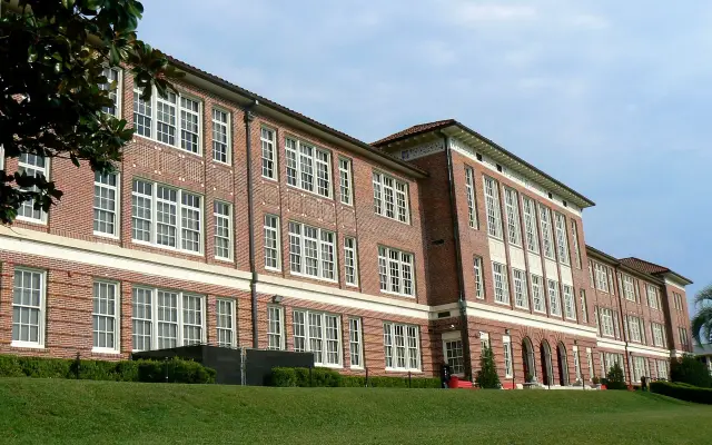
Short answer: Florida Department of State records file six historical markers under Melbourne: Naval Air Station Melbourne (2001), Holy Trinity (2005), the Original Melbourne Village Hall (2005), the William H. Gleason House (2013), the First Congregational Church of Melbourne (2013) and Pentoya at Ballard Park (2013). A Florida Institute of Technology marker (2007) on S. Country Club Road is filed under Cape Canaveral, and more plaques stand in Melbourne Beach and Eau Gallie.
Last verified: October 16, 2026, against the sources listed at the end of this page.
Which Florida historical markers stand in Melbourne?
The Florida Department of State's marker records reviewed for this page file six plaques under the city of Melbourne in Brevard County, from a 2001 Navy air station marker to three 2013 markers.
Each marker has its own public record listing the city, county, year, location and full text. The table below sums up the ones reviewed, including the Florida Institute of Technology marker, which stands on S. Country Club Road but is filed under Cape Canaveral. This list reflects the records reviewed and is not presented as a complete census of every plaque in the area.
| Marker | Year | Location in the state record | City filed under |
|---|---|---|---|
| Naval Air Station Melbourne | 2001 | Former station at the Melbourne Municipal Airport | Melbourne |
| Holy Trinity | 2005 | Corner of Fee Avenue and U.S. 1 | Melbourne |
| Original Melbourne Village Hall | 2005 | 6100 Hall Rd. | Melbourne |
| Florida Institute of Technology | 2007 | S. Country Club Rd. between W. University Blvd. and W. Amherst Ave. | Cape Canaveral |
| The William H. Gleason House | 2013 | 1736 Pineapple Avenue | Melbourne |
| The First Congregational Church of Melbourne | 2013 | 1824 South Harbor City Blvd. | Melbourne |
| Pentoya | 2013 | 924 Thomas Barbour Drive (Ballard Park) | Melbourne |
Taken together the Melbourne plaques cover about 4,000 years: an Ais town site whose artifacts reach back to about 2000 BC, an Eau Gallie founder's house, two congregations from the 1880s, a World War II training base, a postwar community hall and a university born in the space race.
What do the Eau Gallie and Ballard Park markers record?
The Pentoya marker at 924 Thomas Barbour Drive in Ballard Park tells the oldest story, placing the Ais town of Pentoaya on the arc-shaped sand bluffs at the park's western edge.
The marker notes that Pentoaya was one of ten towns on Alvaro Mexia's 1605 map of Indian habitation sites. Artifacts from the site range from fiber-tempered Orange pottery to Malabar II check-stamped pottery, from as early as 2000 BC to as late as AD 1700. The stretch of the Indian River Lagoon from Ballard Park to Floridana Beach was once called Pentoaya Lagoon, and the marker credits the town's location where the Eau Gallie and Indian rivers meet with its economic and political importance. It adds that the winter location of Pentoaya was on a barrier island near present-day Gleason Park in Indian Harbour Beach.
A companion plaque, the Winter-Time Ais Indian Town of Pentoaya marker (2003) at 2055 South Patrick Drive, is filed under Eau Gallie. It records that Spanish Governor Pedro de Ybarra sent Lt. Alvaro Mexia on a diplomatic mission to the Ais in 1605, and that Mexia placed the 17th century town of Pentoaya directly opposite on the western mainland, near the confluence of the Eau Gallie and Indian rivers. The winter town was a complex of shell middens, mounds and a causeway, and little remains because the shells were used as roadbed material early in the 20th century.
In Eau Gallie proper, the William H. Gleason House marker (2013) at 1736 Pineapple Avenue describes a Queen Anne house built around 1884 by William Henry Gleason and his wife, Sarah Griffin Gleason. Gleason bought a 16,000-acre Brevard County tract in 1870 and named the area Eau Gallie, with "Eau" from his hometown, meaning water, and "Gallie" a derivative of a Seminole word meaning rocky. The marker adds that he was Florida's first elected Lieutenant Governor in 1868, was instrumental in framing that year's state constitution, offered right-of-way to bring Henry Flagler's railroad to Eau Gallie in 1887, and that the house was listed on the National Register of Historic Places in 1997.
Which Melbourne churches carry state markers?
Holy Trinity Episcopal Church and the First Congregational Church of Melbourne each have a state marker, both telling stories that begin in the 1880s.
The Holy Trinity marker (2005) at the corner of Fee Avenue and U.S. 1 says the Episcopal congregation organized in 1884 and erected its church in 1886 on land donated by Lucy Boardman, who also provided the plans. The building, of virgin Georgia heart pine, first stood south of Crane Creek, so members from the north side of the creek arrived by boat and, after 1895, by footbridge. It was moved in 1897 to land donated by W.T. Wells at the corner of Fee Avenue and U.S. 1, repaired and stuccoed in 1927, and moved to its present location in 1963.
The First Congregational Church of Melbourne marker (2013) stands at 1824 South Harbor City Boulevard. It traces the church to 1887 Bible study and worship meetings held by Edward Branch and his wife, Abbie, and to a December 1887 covenant signed by five men and seven women. Local businessman W.H. Powell donated a corner lot on Second Street (Strawbridge) and Washington Street (U.S. Hwy. 1) in 1892. Local builder R. J. Anderson designed a frame church with a steeple, completed in 1893 for $2,065, and the marker notes that exactly $2,512.12 had been collected, with the leftover funds starting an organ fund. The first service was held Sunday, July 2, 1893. Four large stucco-covered additions came in 1929 and stained glass windows in 1959, the building served as the United Church of Christ-Congregational from 1960 to 1999, and on January 3, 2000, it was sold to His Place Ministries East Coast, Inc., for continued use as a church.
What does the Naval Air Station Melbourne marker say?
The Naval Air Station Melbourne marker (2001) describes a 129-building station built at the Melbourne Municipal Airport at the start of World War II, commissioned as Operational Training Unit #2 on October 20, 1942, and closed on February 15, 1946.
The marker's figures are specific. More than 2,200 newly commissioned Navy and Marine pilots trained there in Grumman F4F Wildcat and F6F Hellcat fighters, and the station served more than 310 officers and 1,355 enlisted personnel. The plaque also records the cost: 63 pilots died in aerial accidents and two enlisted men in ground-related accidents. It closes by noting that the City of Melbourne Airport Authority now operates the area.
Why does the Florida Tech marker list Cape Canaveral?
The Florida Institute of Technology marker (2007) is filed under Cape Canaveral because its text ties the school's founding to the space program at the Cape.
The plaque itself stands on S. Country Club Road between W. University Boulevard and W. Amherst Avenue near the university, whose contact page gives its address as 150 W. University Blvd., Melbourne.
The marker says founder Jerome P. Keuper (1921 to 2002), a scientist working at Cape Canaveral, founded Florida Tech in 1958 to meet a need for scientists and engineers in the race for space, a story it says began with a 37-cent donation. Astronaut Virgil "Gus" Grissom received Florida Tech's first honorary doctorate in 1962, and Wernher von Braun and Edward Teller were among its first visiting professors. The marker also counts five astronauts among Florida Tech graduates, including Joan Higginbotham and Sunita Williams, who flew together on Space Shuttle Discovery in December 2006.
Which markers stand just outside Melbourne?
The Original Melbourne Village Hall marker is filed under Melbourne but stands in the Town of Melbourne Village, and Melbourne Beach on the barrier island has two plaques of its own.
The Original Melbourne Village Hall marker (2005) at 6100 Hall Rd. tells how a circa 1941 barracks from Banana River Naval Air Station was declared surplus in 1948, sold to the American Homesteading Foundation, barged down the Banana and Indian rivers to Melbourne and trucked out the then two-lane U.S. Route 192. It housed offices of the newly incorporated Town of Melbourne Village from 1957 until 1963, and the town completed its restoration in 2003 with support from a Brevard County grant.
The Juan Ponce de Leon landing marker (2005) at 4005 Hwy. A1A in Melbourne Beach states that, while scholars disagree, the April 1513 landfall may have come in an area just south of Melbourne Beach rather than near St. Augustine. The Old Melbourne Beach Town Hall marker (2008) at 2373 Oak St. describes a 1908 building that faced the Indian River Lagoon and held offices of the Melbourne Beach Improvement Company; it was floated down the river after a new town hall was built in 1953 and opened as a history center in May 2007.
Last verified: October 15, 2026, by re-reading the ten Florida Department of State marker records cited here (NAS Melbourne, Holy Trinity, Original Melbourne Village Hall, Florida Institute of Technology, Gleason House, First Congregational, Pentoya, Winter-Time Pentoaya, Ponce de Leon landing and Old Melbourne Beach Town Hall) and Florida Tech's contact page.
Frequently asked questions
How many state historical markers are in Melbourne, Florida?
The state records reviewed file six markers under Melbourne: NAS Melbourne, Holy Trinity, the Original Melbourne Village Hall, the Gleason House, First Congregational Church and Pentoya. The Florida Tech marker on S. Country Club Road is filed under Cape Canaveral. The list is not presented as complete.
Which is the oldest site marked in Melbourne?
The Pentoya marker at Ballard Park covers the oldest history. It places the Ais town of Pentoaya on sand bluffs at the park's western edge, with artifacts dating from about 2000 BC to AD 1700, and notes the town appeared on Alvaro Mexia's 1605 map.
Where is the Naval Air Station Melbourne marker?
The 2001 marker concerns the former station at the Melbourne Municipal Airport, now operated by the City of Melbourne Airport Authority. It records 129 buildings, commissioning on October 20, 1942, closing on February 15, 1946, and more than 2,200 pilots trained.
What does the Gleason House marker say about the name Eau Gallie?
The 2013 marker on Pineapple Avenue says William H. Gleason named his 1870 Brevard County tract Eau Gallie, with "Eau" from his hometown, meaning water, and "Gallie" a derivative of a Seminole word meaning rocky.
Is the Melbourne Village Hall marker inside Melbourne?
The plaque at 6100 Hall Road stands in Melbourne Village, which the marker describes as a newly incorporated town by 1957, although the state record lists Melbourne as its city. The hall began as a Banana River Naval Air Station barracks and was restored in 2003.
Sources
- Florida Historical Marker Details, Florida Department of State, Division of Historical Resources: Naval Air Station Melbourne (2001) https://markers.flheritage.com/home/details/22 Used for: NAS Melbourne marker text: 129 buildings, commissioning and closing dates, pilots trained, personnel, airport authority
- Florida Historical Marker Details, Florida Department of State, Division of Historical Resources: Florida Institute of Technology (2007) https://markers.flheritage.com/home/details/78 Used for: Florida Tech marker location, 37-cent founding story, Keuper 1958, Grissom honorary doctorate, astronaut graduates
- Florida Historical Marker Details, Florida Department of State, Division of Historical Resources: Holy Trinity (2005) https://markers.flheritage.com/home/details/87 Used for: Holy Trinity Episcopal Church organization 1884, building 1886, Crane Creek crossing, 1897 and 1963 moves
- Florida Historical Marker Details, Florida Department of State, Division of Historical Resources: The William H. Gleason House (2013) https://markers.flheritage.com/home/details/795 Used for: Gleason House on Pineapple Avenue, Eau Gallie naming, 1887 railroad, 1868 lieutenant governor, National Register 1997
- Florida Historical Marker Details, Florida Department of State, Division of Historical Resources: The First Congregational Church of Melbourne (2013) https://markers.flheritage.com/home/details/798 Used for: First Congregational Church covenant 1887, 1893 building and cost, later uses
- Florida Historical Marker Details, Florida Department of State, Division of Historical Resources: Pentoya (2013) https://markers.flheritage.com/home/details/831 Used for: Ais town of Pentoaya at Ballard Park, Mexia 1605 map, artifact date range, Pentoaya Lagoon
- Florida Historical Marker Details, Florida Department of State, Division of Historical Resources: Original Melbourne Village Hall (2005) https://markers.flheritage.com/home/details/95 Used for: barracks moved from Banana River Naval Air Station, American Homesteading Foundation, Town of Melbourne Village offices, 2003 restoration
- Florida Historical Marker Details, Florida Department of State, Division of Historical Resources: Winter-Time Ais Indian Town of Pentoaya (2003) https://markers.flheritage.com/home/details/107 Used for: winter town of Pentoaya on the barrier island opposite the Eau Gallie River mouth, filed under Eau Gallie
- Florida Historical Marker Details, Florida Department of State, Division of Historical Resources: Possible Vicinity of Juan Ponce de Leon's Landing (2005) https://markers.flheritage.com/home/details/96 Used for: Melbourne Beach landing-site marker and the scholarly disagreement it records
- Florida Historical Marker Details, Florida Department of State, Division of Historical Resources: Old Melbourne Beach Town Hall (2008) https://markers.flheritage.com/home/details/767 Used for: 1908 building of the Melbourne Beach Improvement Company and its 2007 reopening as a history center
- Contact, Florida Institute of Technology https://www.fit.edu/contact/ Used for: Florida Tech's own address on W. University Blvd., Melbourne
How this page was made
Digital Towns uses AI assistance to research and write its guides, and every page is only as good as the sources it cites. Our goal is the most accurate, useful local information possible.
This page was fact-checked twice before publishing.
If you see an error, or anything you can show is false, tell us right away and we will take a third look.
Report an error
Thank you. We'll take a third look and correct the page if it's wrong.