Short answer: The St. Sebastian River is the major Indian River Lagoon tributary along Sebastian's western and southern edge. Its watershed covers about 100,000 acres, about 9,000 of them inside the city, with a South Prong in Indian River County and a North Prong in Brevard County. Sebastian lines nearly 9 miles of its banks, Indian River County runs three launches near town, and the river west of the U.S. 1 bridge and north of the State Road 512 bridge is a year-round slow speed manatee zone.
Last verified: October 15, 2026, against the sources listed at the end of this page.
What is the St. Sebastian River?
The St. Sebastian River is the major Indian River Lagoon tributary that forms the western and southern edge of Sebastian.
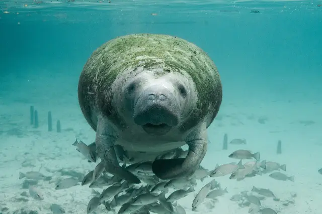
The City of Sebastian calls it a major tributary of the Indian River Lagoon and says the city lies along nearly 9 miles of its lower eastern and southern banks. Indian River County calls the river largely protected and a glimpse of old Florida, with chances to see alligators, manatees, native birds and fish.
The river answers to several names. Florida's manatee rule for Indian River County lists Sebastian River, San Sebastian River and Sebastian Creek as common names for the St. Sebastian River, and includes the waters known as San Sebastian Bay (Rule 68C-22.007). The Brevard County rule likewise lists the South Fork San Sebastian River as also known as St. Sebastian River, Sebastian River and Sebastian Creek (Rule 68C-22.006).
How big is the St. Sebastian River watershed?
The Sebastian River watershed covers about 100,000 acres, of which the City of Sebastian occupies about 9,000, and it reaches into both Indian River and Brevard counties.
Most of the basin lies west of town. The city stormwater division states that agricultural lands west of Sebastian supply a major portion of the runoff. Upstream the river splits into a South Prong in Indian River County and a North Prong in Brevard County, each with a U.S. Geological Survey gauge. The city adds that the St. Johns River and South Florida water management districts identified heavy freshwater inputs and their effect on lagoon salinity as the principal concern for this watershed.
| Measure | Figure | Source |
|---|---|---|
| Whole watershed | about 100,000 acres | City of Sebastian |
| Inside Sebastian city limits | about 9,000 acres | City of Sebastian |
| Riverbank along the city | nearly 9 miles | City of Sebastian |
| South Prong gauge 02251000 near Sebastian | 35 square miles drained, tidal stream | USGS |
| North Prong gauge 02251500 near Micco | 28.5 square miles drained, Brevard County | USGS |
The South Prong gauge is classed as a tidal stream in Indian River County and is run with the St. Johns River Water Management District, and the North Prong gauge sits in Brevard County. On the Brevard side, the state manatee rule groups the North Prong, the North Fork Sebastian River (also called Sebastian Creek) and the C-54 Canal, which it identifies as South Florida Water Management District Canal 54 (Rule 68C-22.006).
Where can a canoe or boat be launched on the St. Sebastian River?
Indian River County runs three public launches on the St. Sebastian River near Sebastian: the Sebastian Canoe Launch on the South Prong, Donald MacDonald Park and Dale Wimbrow Park on Roseland Road.
| Site | Address | Hours | Launch and notes |
|---|---|---|---|
| Sebastian Canoe Launch | 9800 Canoe Launch Cove | Daily 7am to sunset | Canoe and kayak launch dock on the South Prong, 8 parking spaces plus 1 accessible |
| Donald MacDonald Park and Campground | 12315 Roseland Road | Daily 7am to sunset | Boat launch, boardwalk, 13 trailer spaces; campsites $25 primitive, $35 electric per night |
| Dale Wimbrow Park | 11805 Roseland Road | Daily 7:30am to sunset | Boat ramp 7 feet deep at the end, 8 trailer spaces |
| St. Sebastian River Preserve State Park (upper river) | Fellsmere entrance off Buffer Preserve Drive | Opens 8 a.m., closes at sunset | No launch inside the preserve; two canoe landings; no entrance fee |
The Sebastian Canoe Launch is the usual start for a downstream trip: the county describes a three to four hour paddle north toward Donald MacDonald Park, Dale Wimbrow Park or the lagoon and advises arranging drop off and pick up. Donald MacDonald Park (772-226-1875) has 26 primitive campsites and 5 with electricity, caps stays at two weeks with a one week break, and bans alcohol. Dale Wimbrow Park lists a ramp 7 feet deep at its end, the only ramp depth the county publishes for the three launches. One oddity: the county pages give both Roseland Road parks the identical size of 37.19 acres, which looks like a copied figure rather than a measurement.
Upriver, Florida State Parks says all launching facilities for the St. Sebastian River Preserve sit outside the park, while two canoe landings let paddlers step ashore onto its trails. The park is open 8 a.m. to sunset with no entrance fee, and its visitor center is open 10 a.m. to 4:30 p.m. Friday through Sunday (park hours page). A road improvement project runs from Oct. 5 to Nov. 5, 2026, closing the Babcock entrance on weekdays and shutting the stretch from I-95 to the Manatee Overlook Monday through Thursday. Last verified: October 14, 2026, on the Indian River County and Florida State Parks websites.
What are the boat speed rules on the St. Sebastian River?
All navigable water of the St. Sebastian River west and southwest of the U.S. 1 bridge and north of the State Road 512 bridge is a year-round slow speed manatee zone.
That zone in Rule 68C-22.007 covers San Sebastian Bay and the South Fork St. Sebastian River inside Indian River County. North of the county line, Rule 68C-22.006 sets a Sebastian River Area covering the North Prong, the North Fork Sebastian River and part of the C-54 Canal east of its spillway. Upriver, Florida State Parks describes the preserve's Manatee Overlook as a spot for viewing manatees, pelicans and herons over brackish water.
Why is the St. Sebastian River's water quality a concern?
The St. Sebastian River receives considerable fresh water, suspended matter and nutrients from farms west of Sebastian and from the city's 1950s drainage grid into the Indian River Lagoon.
Regulators flagged it decades ago. The City of Sebastian notes that the Indian River Lagoon National Estuary Program (1996) and the Indian River Lagoon SWIM Program (1994) named the river a priority waterbody needing rehabilitation and protection. In the late 1950s General Development Corporation designed the city's streets and drainage for approximately 15,000 single-family home sites, and that network of canals and swales sends most Sebastian stormwater to the river. The city also says grass beds just south of the river mouth have become more fragmented over time.
The same city page says Sebastian's 1950s canals, ditches and swales do not provide the stormwater storage or water quality treatment that present day standards require, and that suspended matter and nutrient loading may degrade water quality and affect local seagrass and shellfish.
The official record is showing its age. The city's drainage history page still cites 1994 and 1996 program designations and says Sebastian is presently experiencing a dramatic population growth, while the same page notes that most of the 15,000 GDC home sites had been developed by the late 1990s. The stormwater division's menu also lists 2023 Stormwater Master Plan information, the newer document to check.
What is being done to protect the St. Sebastian River?
Protection of the St. Sebastian River combines city stormwater filters under a master plan endorsed by the St. Johns River Water Management District and county conservation land along the South Prong.
Inside Sebastian, the city stormwater division has 9 nutrient separating baffle boxes at outfall points and won a 2015 League of Florida Cities environmental stewardship award for its water monitoring program; drainage problems go to the Citizens Request Line at (772) 581-0111. The city's Master Stormwater Management Plan, endorsed by the St. Johns River Water Management District, aims to increase on-site stormwater retention and infiltration to cut pollutant loads and fresh water discharges.
Upstream, Indian River County holds the 37.5-acre South Prong Preserve on both sides of CR 510 (85th Street), a cypress, water hickory and cabbage palm floodplain kept as a buffer for the river; it is not open to the public. Most of its uplands are former citrus groves now left fallow, and the county says ending active farming there reduces the chance of pesticide and herbicide nutrient inputs and rules out residential development beside the river. The county plans passive recreation on the site as funding becomes available.
Frequently asked questions
Is St. Sebastian River Preserve State Park open?
Yes, 8 a.m. to sunset every day with no entrance fee, but a road project from Oct. 5 to Nov. 5, 2026 closes the Babcock entrance on weekdays. All launching facilities for the river sit outside the preserve.
Where can a kayak be launched on the St. Sebastian River?
Indian River County's Sebastian Canoe Launch at 9800 Canoe Launch Cove sits on the South Prong and is open 7am to sunset. Donald MacDonald Park and Dale Wimbrow Park on Roseland Road also have launches downstream.
Is there a speed limit on the St. Sebastian River?
Yes. Florida Rule 68C-22.007 makes all navigable water of the river west and southwest of the U.S. 1 bridge and north of the State Road 512 bridge a year-round slow speed manatee zone in Indian River County.
Can people camp on the St. Sebastian River?
Donald MacDonald Park and Campground at 12315 Roseland Road has 26 primitive sites at $25 a night and electric sites at $35, with a two-week stay limit. St. Sebastian River Preserve State Park also offers primitive and equestrian camping.
Is the St. Sebastian River polluted?
The City of Sebastian says the river is a priority waterbody in need of water quality rehabilitation, with concern over fresh water, suspended matter and nutrient loads from farm and urban runoff. The city has 9 baffle boxes at outfalls, and the county's South Prong Preserve buffers the river.
Sources
- The History of Sebastian Drainage System, City of Sebastian Stormwater https://cityofsebastian.org/434/The-History-of-Sebastian-Drainage-System Used for: 9 miles of riverbank, 9,000 of 100,000 acres, priority waterbody, GDC 1950s drainage, 15,000 home sites, agricultural runoff, seagrass fragmentation, 9 baffle boxes, 2015 award, Citizens Request Line
- Sebastian Canoe Launch, Indian River County https://www.indianriver.gov/business_detail_T21_R27.php Used for: address, hours, South Prong location, three to four hour paddle, parking, rules
- Donald MacDonald Park and Campground, Indian River County https://www.indianriver.gov/business_detail_T21_R9.php Used for: address, phone, hours, campsite fees, boat launch, boardwalk, stay limits, acreage
- Dale Wimbrow Park, Indian River County https://www.indianriver.gov/business_detail_T21_R7.php Used for: address, hours, acreage, boat launch depth, trailer parking
- St. Sebastian River Preserve State Park, Florida State Parks https://www.floridastateparks.org/St-Sebastian Used for: address, natural communities, listed species, trails, launches outside preserve, canoe landings, Manatee Overlook, Oct. 5 to Nov. 5, 2026 road project
- Hours and Fees, St. Sebastian River Preserve State Park https://www.floridastateparks.org/parks-and-trails/st-sebastian-river-preserve-state-park/hours-fees Used for: 8 a.m. to sunset, visitor center hours, no entrance fee
- Fla. Admin. Code R. 68C-22.007, Indian River County manatee zones https://www.law.cornell.edu/regulations/florida/Fla-Admin-Code-Ann-R-68C-22-007 Used for: slow speed zone and river names
- Fla. Admin. Code R. 68C-22.006, Brevard County manatee zones https://www.law.cornell.edu/regulations/florida/Fla-Admin-Code-Ann-R-68C-22-006 Used for: North Prong, Sebastian Creek and C-54 Canal zones
- USGS 02251000 South Prong St Sebastian River near Sebastian https://waterdata.usgs.gov/monitoring-location/02251000/ Used for: 35 square mile drainage area, tidal stream, SJRWMD cooperation
- USGS 02251500 North Prong Saint Sebastian River near Micco https://waterdata.usgs.gov/nwis/inventory/?site_no=02251500 Used for: 28.5 square mile drainage area, Brevard County
- South Prong Preserve, Indian River County https://indianriver.gov/business_detail_T21_R62.php Used for: 37.5 acres, CR 510, not open to the public, floodplain forest, buffer
How this page was made
Digital Towns uses AI assistance to research and write its guides, and every page is only as good as the sources it cites. Our goal is the most accurate, useful local information possible.
This page was fact-checked twice before publishing.
If you see an error, or anything you can show is false, tell us right away and we will take a third look.
Report an error
Thank you. We'll take a third look and correct the page if it's wrong.