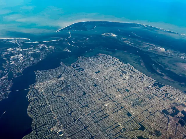
Short answer: The Ais were the people living along the Indian River Lagoon at Sebastian when the Spanish arrived. The U.S. Fish and Wildlife Service dates them at Pelican Island from 2000 BCE to the mid-1600s, and a state marker places their paramount village at the Kroegel homestead just south of Sebastian. Reduced to 137 people by 1711, they were gone by the mid-1740s.
Last verified: October 11, 2026, against the sources listed at the end of this page.
Who were the Ais people of the Sebastian area?
The Ais were the people who lived along the Indian River Lagoon at Sebastian when the Spanish arrived, and the U.S. Fish and Wildlife Service dates their presence at Pelican Island from 2000 BCE to the mid-1600s.
The Service says Pelican Island and the surrounding area were first inhabited by the Ais people between 2000 BCE and the mid-1600s. The St. Lucie Historical Society gives their range as the coast between Cape Canaveral in the north and Fort Pierce in the south, reaching west to the St. Johns River, which puts the Sebastian River mouth and the inlet near the middle of Ais country.
Spanish writers used the people's name for the water itself. The Roseland marker of the Florida Division of Historical Resources says the Ays lived along the confluence of the St. Sebastian River and the Indian River, called the Rio d'ays, when the Spanish arrived in the 1500s. The National Park Service records the same name, Rio d' Ais, for the Indian River and notes that the line between Ais and Timucuan country to the north is still unclear.
The Ais did not farm. The historical society describes hunter-gatherers whose diet was rich in fish, turtle and shellfish, with cocoplums, sabal palm berries and other gathered fruit. The lagoon at Sebastian, with its oyster bars and grass flats, supplied most of that.
What did the Ais leave behind around Sebastian Inlet?
Around Sebastian Inlet the Ais left shell middens, sand mounds, burials and pottery, evidence that Florida State Parks dates to as early as 2000 B.C.
Florida State Parks reports that evidence suggests people have lived in the Sebastian Inlet area since 2000 B.C. Pottery found there carries markings and materials similar to the Glades culture to the south and the St. Johns culture to the north, which the park reads as a zone of contact between coastal groups. Shell middens, the heaped debris of meals, run the length of the barrier island, and sand mounds and human burial remains suggest ceremonial and religious practice.
The 2013 Pentoya marker gives a sense of how long the pottery sequence runs on the Indian River. At that Ais town site to the north, it says, artifacts date from as early as 2000 BC to as late as AD 1700, from fiber-tempered Orange pottery to more recent Malabar II check-stamped ware. The same styles turn up along the lagoon at Sebastian.
Much of the shell is gone. The Eau Gallie marker notes that the mounds at the winter town of Pentoaya were largely removed early in the 20th century, when their shell was used as roadbed material, a fate shared by many Indian River Lagoon middens.
Was the main Ais town at Sebastian?
The newer state marker says yes: a 2013 Florida Division of Historical Resources marker places the Ais paramount village at the Kroegel homestead just south of Sebastian, while an older 2003 marker put the principal town near Vero Beach.
The Pentoya marker in Melbourne, placed in 2013, states that the main settlement of the Ais, their paramount village, was located at the Kroegel homestead just south of the city of Sebastian in Indian River County. The Eau Gallie marker from 2003 describes Alvaro Mexia's 1605 trip down the coast to the principal Ais town near present-day Vero Beach. The two markers record a shift in where historians place the town over a decade, and the Sebastian location is the more recent state reading.
The Kroegel homestead held the largest landmark of that era. Indian River County describes it as including a large prehistoric shell mound, or midden, known as Barker's Bluff, on the west bank of the Indian River. Indian River County Historian Ruth Stanbridge, in a Pelican Island Conservation Society reprint, calls it one of the largest shell mounds along the Indian River and a landmark for river travelers for centuries, and quotes Frieda Kroegel Thompson's description of it as 1,000 feet long and 400 feet wide.
The county keeps part of that ground as the Rodney Kroegel Conservation Area on Indian River Drive. It lists the 2.6 acre site as not open to the public.
Ais timeline for the Sebastian area
The dated points below come from federal, state and county historical sources for the Indian River Lagoon around Sebastian, from first settlement to the end of the Ais as a people.
| Date | Event | Source |
|---|---|---|
| 2000 BCE | Ais presence begins at Pelican Island and around Sebastian Inlet | U.S. Fish and Wildlife Service; Florida State Parks |
| circa 1563 | Oathaqua named as a major Ais chief | St. Lucie Historical Society |
| 1597 | Governor Mendez de Canco reports the Ais chief rules more people than any other he knows | St. Lucie Historical Society |
| 1605 | Mexia maps ten towns, Pentoaya among them; Ais warriors aid Spain against the French | Florida Division of Historical Resources; St. Lucie Historical Society |
| 1696 | Jonathan Dickinson party, shipwrecked, meets the Ais on the way north | St. Lucie Historical Society |
| after 1703 | Ais absorbed into the Costas | St. Lucie Historical Society |
| 1711 | 137 individuals remain | St. Lucie Historical Society |
| mid-1740s | Remaining Ais and Costas gone, chiefly from European disease | St. Lucie Historical Society |
What do Spanish records say about the Ais near Sebastian?
Spanish records portray the Ais of the Sebastian coast as a large chiefdom that Spain courted as an ally, with a chief reported in 1597 to command more people than any other Florida leader the governor had met.
The St. Lucie Historical Society names Oathaqua as a major Ais chief around 1563 and cites Governor Mendez de Canco's 1597 report that the Ais chief had more Indians under him than any other tribe he had contact with. It also states that the Ais were friendly with the Spanish and sent warriors in 1605 to help them against the French. The society notes that the Ais both took in and turned on shipwrecked sailors, a reminder that the coast from Sebastian Inlet south was dangerous ground for crews from wrecked ships.
The Spanish mapped Ais towns as well. The Pentoya marker says Pentoaya was one of ten towns recorded on Alvaro Mexia's 1605 map of Indian habitation sites along the lagoon. The Spanish treasure fleet that wrecked off the barrier island in 1715 arrived after the Ais had already been absorbed into other groups; that era is covered on the Spanish colonial page.
What happened to the Ais?
The Ais of the Sebastian coast shrank to 137 people by 1711 and disappeared as a separate people by the mid-1740s, chiefly from diseases brought by Europeans.
The St. Lucie Historical Society says that after 1703 the tribe was absorbed into the Costas, that their numbers had diminished to 137 individuals by 1711, and that European diseases eradicated the remaining Ais and Costas by the mid-1740s. The Service's end date of the mid-1600s for Ais presence at Pelican Island is earlier, and the two sources describe different places and measures: one island versus the whole people.
What survives near Sebastian is physical. The Sebastian Area Historical Society says the Ais left behind shells and pottery that were found and donated, and its museum on Main Street displays Ais relics alongside shipwreck artifacts and Pelican Island history. Florida State Parks interprets the area's prehistory at the McLarty Treasure Museum at Sebastian Inlet State Park, on the barrier island where the middens run.
Frequently asked questions
How long did the Ais live near Sebastian?
The U.S. Fish and Wildlife Service dates Ais presence at Pelican Island from 2000 BCE to the mid-1600s, and Florida State Parks says people have lived around Sebastian Inlet since 2000 B.C. The St. Lucie Historical Society says the last Ais were gone by the mid-1740s.
Where was the main Ais town?
A 2013 Florida Division of Historical Resources marker places the Ais paramount village at the Kroegel homestead just south of Sebastian, at the shell mound called Barker's Bluff. An older 2003 marker placed the principal town near present-day Vero Beach.
What did the Ais eat?
The St. Lucie Historical Society describes the Ais as hunter-gatherers whose diet was rich in fish, turtle and shellfish, with cocoplums and sabal palm berries. The shell middens along the Indian River Lagoon at Sebastian record those meals.
Can Barker's Bluff be visited?
Not at present. The surviving part of the Kroegel homestead is Indian River County's Rodney Kroegel Conservation Area on Indian River Drive, a 2.6 acre site the county lists as not open to the public.
Where can Ais artifacts be seen in Sebastian?
The Sebastian Area Historical Museum on Main Street exhibits Ais shells, pottery and other relics donated by local residents, and the McLarty Treasure Museum at Sebastian Inlet State Park interprets the area's prehistory.
Sources
- Pelican Island National Wildlife Refuge, About Us, U.S. Fish and Wildlife Service https://www.fws.gov/refuge/pelican-island/about-us Used for: Ais inhabited Pelican Island and the surrounding area between 2000 BCE and the mid-1600s
- History and Culture of Sebastian Inlet, Florida State Parks https://www.floridastateparks.org/learn/history-and-culture-sebastian-inlet Used for: habitation since 2000 B.C.; pottery like the Glades and St. Johns cultures; shell middens; sand mounds and burials; McLarty Treasure Museum covers the prehistory
- Pentoya historical marker (2013), Florida Division of Historical Resources https://markers.flheritage.com/home/details/831 Used for: paramount Ais village at the Kroegel homestead south of Sebastian; Pentoaya one of ten towns on Mexia's 1605 map; artifacts 2000 BC to AD 1700; Orange and Malabar II pottery
- Winter-time Ais Indian Town of Pentoaya marker (2003), Florida Division of Historical Resources https://markers.flheritage.com/home/details/107 Used for: Mexia's 1605 mission to the principal Ais town placed near Vero Beach; winter and summer towns; mounds used as roadbed
- Roseland historical marker (2014), Florida Division of Historical Resources https://markers.flheritage.com/home/details/842 Used for: Ays lived at the confluence of the St. Sebastian and Indian rivers (Rio d'ays) when the Spanish arrived
- Early Native Americans, St. Lucie Historical Society https://stluciehistoricalsociety.net/early-native-americans/ Used for: Ais range; Dickinson party 1696; chief Oathaqua circa 1563; Mendez de Canco report of 1597; warriors sent in 1605; absorbed into the Costas after 1703; 137 people by 1711; gone by the mid-1740s; diet
- Canaveral National Seashore: Pre-Columbian People, National Park Service https://www.nps.gov/articles/000/pre-columbian.htm Used for: Indian River once called Rio d' Ais by the Spanish; Ais language and boundary uncertainty
- Rodney Kroegel Conservation Area, Indian River County https://indianriver.gov/business_detail_T21_R50.php Used for: Barker's Bluff prehistoric shell midden on the Kroegel homestead; site not open to the public
- Paul Kroegel and the Story of Pelican Island, Ruth Stanbridge, Indian River County Historian (Pelican Island Conservation Society reprint) http://www.firstrefuge.org/paul-kroegel-and-the-story-of-pelican-island Used for: Barker's Bluff size and use as a river landmark
- Collections and Exhibits, Sebastian Area Historical Society https://www.sebastianareahistoricalmuseum.com/collections-exhibits Used for: Ais shells and pottery donated and exhibited in the Sebastian museum
How this page was made
Digital Towns uses AI assistance to research and write its guides, and every page is only as good as the sources it cites. Our goal is the most accurate, useful local information possible.
This page was fact-checked twice before publishing.
If you see an error, or anything you can show is false, tell us right away and we will take a third look.
Report an error
Thank you. We'll take a third look and correct the page if it's wrong.