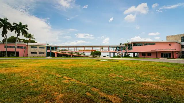
Short answer: Wabasso is an unincorporated Indian River County community near the Indian River Lagoon next to the City of Sebastian, governed by the Board of County Commissioners under a corridor plan approved April 4, 2017. Its public places are West Wabasso Park and the 111-acre Wabasso Scrub Conservation Area on 64th Avenue, Wabasso Causeway Park with a boat ramp on County Road 510, and the guarded Wabasso Beach Park. The 1970 Wabasso Bridge was renamed the A.B. Michael Bridge in 2020.
Last verified: October 15, 2026, against the sources listed at the end of this page.
Where is Wabasso, and who governs it?
Wabasso is one of Indian River County's unincorporated communities, so the Board of County Commissioners, not a city council, sets its rules (2017 Wabasso Corridor Plan).
The same plan places Wabasso near the Indian River Lagoon, extending west to 66th Avenue, where U.S. 1 meets County Road 510.
No town hall stands in Wabasso. Land use there follows the Wabasso Corridor Plan, which residents, property owners and business owners prepared to set development standards for the corridor. The county posts a 2000 version and an update approved by the Board of County Commissioners on April 4, 2017. Permits, zoning and park rules all come from Indian River County offices, not Sebastian City Hall.
Postal addresses make the boundary confusing. The Florida Department of Health in Indian River County lists its Wabasso satellite site with a mailing address of 8445 64th Ave., Wabasso, FL 32970. A few blocks away, West Wabasso Park carries an 8900 64th Avenue, Sebastian, FL 32958 address, while Wabasso Causeway Park and Wabasso Beach Park across the lagoon use Vero Beach 32963 addresses. A Sebastian or Vero Beach mailing address in this area does not mean the property is inside either city.
The river itself is measured here. The U.S. Geological Survey keeps monitoring location 02251800, Indian River at Wabasso, with daily records that begin on October 1, 1969 and continuous data from October 1, 2007. Wabasso Beach is also the southern end of a federal refuge: the U.S. Fish and Wildlife Service describes the Archie Carr National Wildlife Refuge, established in 1991, as 20.5 miles of beach between Melbourne Beach and Wabasso Beach in Brevard and Indian River counties.
Which public places in Wabasso can be visited, and when are they open?
Wabasso has four Indian River County public sites, from West Wabasso Park and the scrub preserve on 64th Avenue to the causeway park and the guarded Wabasso Beach Park on County Road 510.
| Site | Address | Hours | Key facts |
|---|---|---|---|
| West Wabasso Park | 8900 64th Avenue | 7 a.m. to sunset | Playground, two lighted basketball courts, lighted pickleball court, lighted multi-purpose field; field reservations 772-226-1780 |
| Wabasso Scrub Conservation Area | Entrance at West Wabasso Park | 7:30 a.m. to sunset (county) | 111 acres bought in 1995; 1-mile trail; dogs on leash |
| Wabasso Causeway Park | 3105 Wabasso Beach Road (CR 510) | 7 a.m. to sunset | 13.4 acres on four lobes; boat ramp on the south-east lobe; 9 pavilions |
| Wabasso Beach Park | 1820 Wabasso Beach Road | 7 a.m. to sunset; lifeguards 9:10 a.m. to 4:50 p.m. | 0.46 acres; 34 parking spaces plus 4 accessible; beach hotline 772-226-3384 |
| DOH Wabasso satellite site | 8445 64th Ave. | Call ahead | Phone 772-794-7480; senior meals, WIC and food pantry with partners |
West Wabasso Park is the mainland gathering place. The county lists two pavilions, 10 picnic tables and three grills at West Wabasso Park, along with outdoor fitness equipment and a walking trail. On the causeway, Wabasso Causeway Park puts its boat ramp and restrooms on the south-east lobe and lists 9 grills, 9 pavilions and 14 picnic tables, with shoreline for wading, fishing and launching canoes.
Wabasso Beach Park is small and fills quickly. Indian River County lists 0.46 acres with 34 parking spaces and 4 handicap spaces at 1820 Wabasso Beach Road, and allows fishing outside the guarded area, surfing and scuba diving during park hours. Sea turtle nesting season on this beach runs from March 1 to October 31, and the county asks beachgoers to fill any holes before leaving. County rules bar pets, alcohol, camping and overnight parking at the Wabasso parks.
Last verified: October 14, 2026, on the Indian River County website.
What is in the Wabasso Scrub Conservation Area?
The Wabasso Scrub Conservation Area is a 111-acre Indian River County preserve, bought in 1995, that protects sand pine scrub and the Florida scrub-jays tied to the Sebastian Highlands habitat plan (Indian River County).
The county breaks the land into 53 acres of sand pine and scrub oak and scrubby flatwoods, 15 acres of wet prairies and 41 acres of pine flatwoods. Florida scrub-jays and gopher tortoises have been studied on the site since 2000. The preserve is part of the Sebastian Area-Wide Florida Scrub Jay Habitat Conservation Plan, approved by the U.S. Fish and Wildlife Service and finalized in March 2000, and managing it in part mitigates the incidental take of scrub-jays within platted lots in the Sebastian Highlands. That link is why a county preserve outside the city matters to lot owners inside Sebastian.
The walk starts at West Wabasso Park. The Great Florida Birding and Wildlife Trail directs visitors to the trailhead and entrance kiosk in the southeast corner of West Wabasso Park and describes a 1-mile trail through sand pine scrub, oak scrub and seasonal wetlands, where four families of scrub-jays use the eastern and southern portions. The trail notes that shade is scarce and that early morning and late afternoon are the best hours.
The official numbers do not agree. The scrub area page gives 111 acres and hours of 7:30 a.m. to sunset, the birding trail lists 7 a.m., and the West Wabasso Park page calls the preserve a 130-acre xeric scrub habitat. Until the county reconciles them, the 7:30 a.m. opening on the conservation page is the safer plan for an early walk.
How did a dock at Two Dollar Bluff become the Wabasso Bridge?
The Wabasso crossing began as the Michael family dock at Two Dollar Bluff, became a wooden swing bridge to Orchid, and was replaced in 1970 by the causeway and high-arch Wabasso Bridge on County Road 510 (Florida Department of State marker).
Two Dollar Bluff appears on the U.S. Geodetic Map of 1887 and served as a navigational aid on the Indian River. The 2020 state marker says the bluff was an Ais Indian midden on land owned by settler and citrus grower A.B. Michael, and that by 1927 its shell, pottery shards and bones were almost gone, hauled away for road material.
The wooden bridge reshaped northern Indian River County. It carried citrus from the Orchid Island groves to the railroad and opened the area to tourism and land development. During World War II the Wabasso bridge was limited to island residents, with the bridge tender checking credentials. In 2020 the 1970 Wabasso Bridge was renamed the A.B. Michael Bridge, though the county park pages still use the Wabasso Causeway name. The marker adds that the bridge leads to Treasure Coast beaches where remnants of the 1715 Spanish fleet are still found.
What is the history of Allen Chapel AME Church and the Wabasso school?
Allen Chapel AME Church began as Beulah AME, the first Wabasso house of worship tied to a national congregation, and its land also held a Rosenwald-funded school built in 1927 (Florida Department of State marker).
The 2016 marker records that the founders settled in Wabasso in the early 1900s as laborers in agriculture, lumber, turpentine and construction, and that John Knowles, Sam Caswell and Thomas Jackson donated the land for a church and a school. The first sanctuary went up in 1916 and doubled as a classroom. The Julius Rosenwald Fund then provided seed money for Douglas Elementary School on the same tract in 1927. The congregation took the Allen Chapel name in 1943, and the sanctuary dedicated in 1957 is the third on the site.
The Rosenwald Fund card file, held by Fisk University, includes a school photo card for the Wabassa School, alternate name Wabasso School, Indian River County, application number 21-G. The marker gives the church location as 6425 85th Street, while the county corridor plan page lists the February 6, 2017 meeting at Allen Chapel AME Church at 6245 85th Street, so one of the two official listings carries transposed digits.
What have Indian River County and the state done for Wabasso infrastructure?
New water systems, three phases of sewer, paved roads and sidewalks in Wabasso are credited to a Florida Department of Health in Indian River County partnership with residents that started in 2004 and returned in 2021 (DOH Indian River).
The department says its first Protocol for Assessing Community Excellence in Environmental Health (PACE-EH) project in Wabasso, begun in 2004, led to new water systems, three phases of sewer, park improvements, paved roads, better drainage, streetlights and sidewalks, and the rehabbing of more than 20 homes. A second Wabasso PACE-EH project followed in 2021, and the Wabasso satellite site now offers a congregate meal site for seniors 5 days a week with the Senior Resources Association, WIC, a food pantry and help applying for utility and rent assistance with Indian River County Human Services. The site phone is 772-794-7480.
Planning ran in parallel. The county held the Wabasso Corridor Plan update meetings on August 2, 2016 and October 3, 2016 at the Dasie Hope Center, 8445 64th Ave, and on February 6, 2017 at Allen Chapel AME Church, before the April 4, 2017 approval (Indian River County). For a Wabasso question about permits or zoning, the corridor plan and the county planning division are the first stop, not the City of Sebastian.
Frequently asked questions
Is Wabasso part of Sebastian?
No. Wabasso is unincorporated Indian River County, governed by the Board of County Commissioners under the Wabasso Corridor Plan approved April 4, 2017. Some Wabasso properties, such as West Wabasso Park, carry Sebastian 32958 mailing addresses, but that does not place them inside the city.
What was the Wabasso Bridge renamed?
The 1970 Wabasso Bridge on County Road 510 was renamed the A.B. Michael Bridge in 2020, according to the Florida Department of State marker. It honors the settler and citrus grower whose dock at Two Dollar Bluff started the crossing to Orchid Island.
What are the hours at Wabasso Beach Park?
Indian River County lists Wabasso Beach Park, 1820 Wabasso Beach Road, as open daily from 7 a.m. to sunset, with lifeguards on duty from 9:10 a.m. to 4:50 p.m. The beach condition hotline is 772-226-3384, and pets and alcohol are not allowed.
Where does the Wabasso Scrub trail start?
The trailhead and entrance kiosk sit in the southeast corner of West Wabasso Park, 8900 64th Avenue. A 1-mile trail crosses sand pine scrub and oak scrub where Florida scrub-jays live. The county lists hours of 7:30 a.m. to sunset and requires dogs on a leash.
When was Allen Chapel AME Church in Wabasso founded?
The congregation began as Beulah AME Church, whose first sanctuary was built in 1916, according to the 2016 state marker. It was renamed Allen Chapel AME Church in 1943, and the present sanctuary, dedicated in 1957, is the third on the site.
Sources
- A.B. Michael (Wabasso) Bridge, Florida Historical Marker (Florida Department of State, 2020) https://markers.flheritage.com/home/details/1133 Used for: Two Dollar Bluff, Ais midden, Michael family dock, swing bridge to Orchid, World War II limits, 1970 Wabasso Bridge, 2020 renaming, 1715 fleet beaches
- Allen Chapel African Methodist Episcopal Church, Florida Historical Marker (Florida Department of State, 2016) https://markers.flheritage.com/home/details/941 Used for: Beulah AME, early 1900s laborers, land donors, 1916 sanctuary, Douglas Elementary 1927, 1943 renaming, 1957 sanctuary, 6425 85th Street location
- Wabassa School, Indian River County (Rosenwald Fund Collection, Fisk University Franklin Library) https://rosenwald.fisk.edu/s/rosenwald-fund-collection/item/59735 Used for: school card for Wabassa (Wabasso) School, application 21-G
- Wabasso Corridor Plan (Indian River County) https://www.indianriver.gov/services/community_development/wabasso_corridor_plan.php Used for: purpose, 2000 plan, April 4, 2017 BCC approval, 2016 and 2017 meetings, Allen Chapel listed at 6245 85th Street
- Wabasso Satellite Location (Florida Department of Health in Indian River County) https://indianriver.floridahealth.gov/programs-and-services/wabasso/ Used for: PACE-EH 2004 and 2021, results, phone 772-794-7480, mailing address 8445 64th Ave., Wabasso 32970, services
- Wabasso Scrub Conservation Area (Indian River County Parks, Recreation and Conservation) https://www.indianriver.gov/business_detail_T21_R63.php Used for: 111 acres, 1995 purchase, habitats, 7:30 a.m. hours, rules, scrub-jay studies since 2000, Sebastian Area-Wide HCP March 2000
- Wabasso Scrub Conservation Area (Great Florida Birding and Wildlife Trail, FWC) https://floridabirdingtrail.com/site/wabasso-scrub-conservation-area/ Used for: West Wabasso Park trailhead, 1-mile trail, species, 7 a.m. hours
- Wabasso Causeway Park (Indian River County) https://www.indianriver.gov/business_detail_T21_R34.php Used for: 13.4 acres, four lobes, ramp 6 feet deep, 7 a.m. to sunset, amenities, rules
- Wabasso Beach Park (Indian River County) https://indianriver.gov/business_detail_T21_R33.php Used for: 1820 Wabasso Beach Road, 0.46 acres, lifeguards 9:10 a.m. to 4:50 p.m., 34 parking spaces, hotline, turtle season
- West Wabasso Park (Indian River County) https://indianriver.gov/business_detail_T21_R35.php Used for: 8900 64th Avenue, amenities, 7 a.m. to sunset, field reservations 772-226-1780, 130-acre scrub figure
- About Us, Archie Carr National Wildlife Refuge (U.S. Fish and Wildlife Service) https://www.fws.gov/refuge/archie-carr/about-us Used for: 20.5 miles between Melbourne Beach and Wabasso Beach, established 1991
- Indian River at Wabasso, FL, USGS-02251800 (U.S. Geological Survey) https://waterdata.usgs.gov/monitoring-location/02251800 Used for: monitoring location name, daily data from 1969-10-01, continuous data from 2007-10-01
- Wabasso Corridor Plan 2017 (Indian River County) https://www.indianriver.gov/Document%20Center/Services/Planning-and-Development/Wabasso%20Corridor%20Plan/2017-Wabasso-Corridor-Plan.pdf#page=3 Used for: Wabasso is an unincorporated community; extends west to 66th Avenue near the lagoon at U.S. 1 and CR 510
How this page was made
Digital Towns uses AI assistance to research and write its guides, and every page is only as good as the sources it cites. Our goal is the most accurate, useful local information possible.
This page was fact-checked twice before publishing.
If you see an error, or anything you can show is false, tell us right away and we will take a third look.
Report an error
Thank you. We'll take a third look and correct the page if it's wrong.