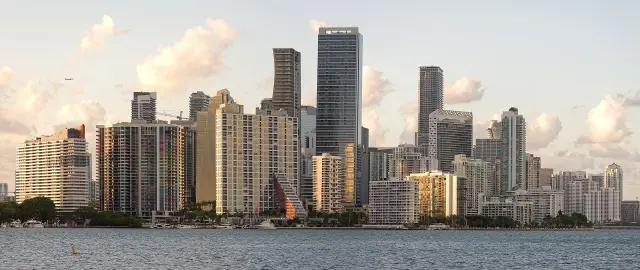
Short answer: The City of Miami groups its neighborhood association lists under 11 areas: Allapattah, Coconut Grove, Coral Way, Wynwood and Edgewater, Flagami, Little Haiti, Downtown and Brickell, Little Havana, Model City, Overtown and Upper Eastside. The old NET offices are now Commission District Offices. Citywide, the Census Bureau counts 223,826 homes, 48.8 percent in buildings of 20 or more units (ACS 2020-2024), and each lot's rules come from its Miami 21 transect zone, historic status and flood zone.
Last verified: October 15, 2026, against the sources listed at the end of this page.
How does the City of Miami divide its neighborhoods?
The City of Miami keeps its neighborhood association lists under 11 areas: Allapattah, Coconut Grove, Coral Way, Wynwood and Edgewater, Flagami, Little Haiti, Downtown and Brickell, Little Havana, Model City, Overtown and Upper Eastside.
The city's homeowner association page sorts homeowner and neighborhood association contact lists by district, because some applications, such as special events and temporary use permits, require letters to those associations (City of Miami). Each list is tied to an office: Allapattah, Coral Way, Flagami and Little Havana appear as district offices, while Coconut Grove, Wynwood and Edgewater, Little Haiti, Downtown and Brickell, Model City, Overtown and Upper Eastside appear as service centers (City of Miami).
| Neighborhood area | Office label on the city HOA list |
|---|---|
| Allapattah | District office |
| Coconut Grove | Service center |
| Coral Way | District office |
| Wynwood and Edgewater | Service center |
| Flagami | District office |
| Little Haiti | Service center |
| Downtown and Brickell | Service center |
| Little Havana | District office |
| Model City | Service center |
| Overtown | Service center |
| Upper Eastside | Service center |
The service center labels are out of date. The city's Commissioner District Offices page says the Neighborhood Service Centers, formerly NET, have been dissolved, that the division no longer exists, and that the offices are now called Commission District Offices (City of Miami). The services have been taken over by various city departments and the offices are handled by each district, and the city's general line is 311 or 305-468-5900, at the Miami Riverside Center, 444 SW 2nd Ave (City of Miami).
Downtown and Brickell also fall within the work of the Miami Downtown Development Authority, which runs a Brickell block walk (Miami DDA). The DDA reports that more than 101,000 people now live in Downtown Miami (Miami DDA) and that Greater Downtown Miami has more than 200 residential buildings (Miami DDA).
What does Miami housing look like across its neighborhoods?
Across all Miami neighborhoods, the Census Bureau counts 223,826 homes, nearly half of them in buildings of 20 or more units and fewer than a quarter as detached single-family houses.
In the 2020 to 2024 American Community Survey for the City of Miami, 48.8 percent of housing units are in structures of 20 or more units (U.S. Census Bureau ACS 2020-2024) and 22.4 percent are one-unit detached houses (U.S. Census Bureau ACS 2020-2024). The survey also shows how old the housing stock is: 7.8 percent of Miami units were built in 1939 or earlier (U.S. Census Bureau ACS 2020-2024), and 16.1 percent were built from 2010 to 2019 (U.S. Census Bureau ACS 2020-2024).
| Measure | City of Miami |
|---|---|
| Housing units | 223,826 |
| Vacant share | 13.0 percent |
| Vacant units held for seasonal or occasional use | 9,480 of 29,005 |
| Units in buildings of 20 or more units | 48.8 percent |
| One-unit detached houses | 22.4 percent |
| Built 1939 or earlier | 7.8 percent |
| Built 2010 to 2019 | 16.1 percent |
| Built 2020 or later | 3.2 percent |
| Owner-occupied share of occupied homes | 30.8 percent |
| Median value, owner-occupied | $518,100 |
| Median gross rent | $1,758 |
Miami is a renter city. Owners live in 30.8 percent of occupied Miami homes (U.S. Census Bureau ACS 2020-2024), the owner-occupied median value is $518,100 and the median gross rent is $1,758 (U.S. Census Bureau ACS 2020-2024). Of 29,005 vacant units citywide, 9,480 are held for seasonal, recreational or occasional use (U.S. Census Bureau ACS 2020-2024). The Brickell condos guide gives the same measures for the 33131 ZIP area.
How can a buyer find the zoning of a Miami home?
Every lot in the City of Miami has a Miami 21 transect zone, such as T4-L or D1, which a buyer can read from the city GIS map tool under the zoning tab.
Miami 21 is the city zoning code, and it adopts the Miami 21 Atlas, which acts as the official Zoning Atlas of the City, is filed in the City Clerk's office and designates a transect zone for all lands in Miami (City of Miami). The city's lookup page gives the steps: enter the address in the GIS map tool, open the zoning tab, and read the zone column, labeled T4-L, C-CI, D1 and so on (City of Miami). The same page warns to check the Areas of Specific Designation box: if it says SD, a special district, the owner needs a Class II special permit (City of Miami).
Whether a use is allowed comes from Article 4, Table 3 of Miami 21. An R means the use is allowed by right, a W means it needs a warrant, an E means it needs an exception, which requires a hearing and is granted by the Planning, Zoning and Appeals Board, and a blank box means the use is prohibited in that Miami zone (City of Miami). For a buyer weighing a duplex in Little Havana or a home office in Coral Way, that table is the answer the City of Miami itself gives.
How can a buyer tell if a Miami home is in a historic district?
The City of Miami GIS map shows historic status: after searching an address, turning on the Historic Preservation and Historic Districts layers highlights a designated property in orange or purple.
The city's Determine a Historic Property page is written for owners and for people considering buying, and it notes that historic properties carry different rules and regulations for any future alterations (City of Miami). The lookup uses the same GIS tool as zoning; the city warns that the tool auto-populates addresses in a specific format, so typing slowly helps (City of Miami).
Designation decisions sit with the Historic and Environmental Preservation Board, which identifies and designates properties of major significance and closely monitors alterations to them (City of Miami). The Miami board has nine members and one alternate member, appointed by the City Commission, and the preservation officer can be reached at 305-416-1551 (City of Miami).
Which Miami neighborhood has its own design review?
Wynwood does: projects inside the Wynwood NRD-1 boundaries go before the Wynwood Design Review Committee, which judges whether they fit the character of the Wynwood Arts District.
The committee reviews and recommends to the Director of Planning, the Zoning Administrator and the Urban Development Review Board, under NRD-1 and Miami 21, whether developments and improvements within the NRD-1 boundaries are compatible with the cultural and architectural character of the Wynwood Arts District (City of Miami). It meets monthly except in August, and submittals for a meeting are due by 4:00 p.m. on the last Wednesday of the preceding month (City of Miami). That extra step affects anyone buying a Wynwood building to renovate, on top of the citywide zoning and historic checks.
Where can a buyer check flood risk for a Miami neighborhood?
For any Miami neighborhood, the Miami-Dade County Flood Zone Hotline at 305-372-6466 confirms a property's flood zone, and the county stormwater staff will visit a property on request.
The Miami-Dade County flood page tells owners unsure of their place on the map to call the hotline, where the exact flood zone designation will be confirmed (Miami-Dade County). Its Stormwater Utility Section also provides site visits and advice on protecting property from flooding (Miami-Dade County). The county page also points Miami owners to the FEMA Map Service Center, where the flood maps for any neighborhood from Flagami to the Upper Eastside can be downloaded (Miami-Dade County).
Other guides in the Miami real estate section go further: the Brickell condos guide covers the Downtown and Brickell tower district in detail, and the Miami luxury condos 2026 guide explains the condo inspection, reserve and deed tax rules.
Last verified: October 15, 2026, on the City of Miami, Miami-Dade County, Miami DDA and U.S. Census Bureau websites.
Frequently asked questions
What are the official neighborhoods of the City of Miami?
The city keeps neighborhood association lists for 11 areas: Allapattah, Coconut Grove, Coral Way, Wynwood and Edgewater, Flagami, Little Haiti, Downtown and Brickell, Little Havana, Model City, Overtown and Upper Eastside. Those lists exist because applications such as special events and temporary use permits require letters to the associations.
Does Miami still have NET offices?
No. The City of Miami says its Neighborhood Service Centers, formerly NET, were dissolved, the division no longer exists, and the offices are now Commission District Offices. Residents can also call 311 or 305-468-5900.
How is the zoning of a Miami property found?
Search the address in the City of Miami GIS map tool, open the zoning tab and read the Miami 21 transect zone, such as T4-L or D1. Article 4, Table 3 of Miami 21 then shows whether a use is allowed by right, by warrant, by exception or not at all.
How can a buyer tell if a Miami house is historic?
In the City of Miami GIS tool, search the address and turn on the Historic Preservation and Historic Districts layers. A property highlighted in orange or purple is designated historic and carries different rules for future alterations.
What share of Miami homes are owner occupied?
Owners occupy 30.8 percent of occupied homes in the City of Miami in the 2020 to 2024 American Community Survey. The median value of owner-occupied homes is $518,100 and the median gross rent is $1,758.
Sources
- City of Miami, Homeowners Associations (HOA) https://www.miami.gov/My-Home-Neighborhood/Homeowners-Associations-HOA Used for: the 11 neighborhood areas whose HOA and neighborhood association lists the city keeps, and which are labeled district office or service center
- City of Miami, Commissioner District Offices https://www.miami.gov/My-Home-Neighborhood/District-Offices Used for: Neighborhood Service Centers (formerly NET) dissolved, offices now Commission District Offices
- City of Miami, Find your Property's Zoning Category https://www.miami.gov/Planning-Zoning-Land-Use/Land-Property-Usage/Find-your-Propertys-Zoning-Category Used for: GIS lookup, transect zones such as T4-L, special district Class II permit, R, W, E and blank uses in Article 4 Table 3, PZAB
- City of Miami, View City of Miami Zoning Code (Miami 21) https://www.miami.gov/Planning-Zoning-Land-Use/View-City-of-Miami-Zoning-Code-Miami-21 Used for: Miami 21 Atlas as the official zoning atlas filed with the City Clerk, transect zone for all lands
- City of Miami, Determine a Historic Property https://www.miami.gov/Permits-Construction/Historically-Designated-Properties/Determine-a-Historic-Property Used for: GIS layers for Historic Preservation and Historic Districts, orange or purple highlight
- City of Miami, Historic and Environmental Preservation Board https://www.miami.gov/My-Government/Boards-Committees/Historic-Environmental-Preservation-Board-HEPB Used for: nine members and one alternate appointed by the City Commission, preservation officer phone
- City of Miami, Wynwood Design Review Committee https://www.miami.gov/My-Government/Boards-Committees/Wynwood-Design-Review-Committee-WDRC Used for: NRD-1 design review in the Wynwood Arts District, monthly meetings except August, submittal deadline
- U.S. Census Bureau, ACS 2020-2024 5-year DP04, Miami city https://data.census.gov/api/access/data/table?id=ACSDP5Y2024.DP04&g=160XX00US1245000 Used for: citywide housing units, vacancy, units in structure, year built, tenure, median value, median gross rent
- U.S. Census Bureau, ACS 2020-2024 5-year B25004, Miami city https://data.census.gov/api/access/data/table?id=ACSDT5Y2024.B25004&g=160XX00US1245000 Used for: vacant units held for seasonal, recreational or occasional use
- Miami DDA, Downtown Details, Data and Demographics https://www.miamidda.com/Business-Development/Data-Research/Downtown-Details-Data-and-Demographics Used for: more than 101,000 Greater Downtown residents
- Miami-Dade County, Flood Zone Maps https://www.miamidade.gov/global/economy/building/flood-protection/flood-zone-maps.page Used for: Flood Zone Hotline, site visits, Stormwater Utility Section
- Miami DDA, Block Walk (Brickell) https://www.miamidda.com/Events-directory/Block-Walk Used for: Miami DDA runs a Brickell block walk
How this page was made
Digital Towns uses AI assistance to research and write its guides, and every page is only as good as the sources it cites. Our goal is the most accurate, useful local information possible.
This page was fact-checked twice before publishing.
If you see an error, or anything you can show is false, tell us right away and we will take a third look.
Report an error
Thank you. We'll take a third look and correct the page if it's wrong.