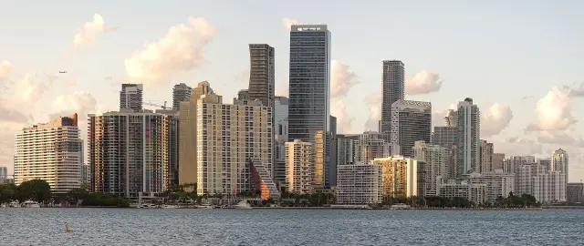
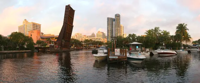
Short answer: Miami's environment questions center on Biscayne Bay, rising water and the Everglades. The 2026 Miami-Dade County Biscayne Bay Report Card finds every bay region in poor or fair condition, and NOAA's Virginia Key gauge shows relative sea level rising 1.26 inches per decade. The City of Miami's Miami Forever Bond allocates $192 million to sea level rise mitigation and flood prevention, while county DERM takes pollution and mangrove reports at 305-372-6955. Four deeper guides cover the bay, sea level, mangroves and the Everglades edge.
Last verified: October 15, 2026, against the sources listed at the end of this page.
Which Miami environment guide answers which question?
The Miami environment section has four deeper guides, on Biscayne Bay, sea level rise, the mangrove coastline and the Everglades edge, and this hub answers the questions that send residents to each one.
Two governments share the work. The City of Miami posts King Tide dates (City of Miami King Tides), lists neighborhood flood projects under Resilience and Public Works (City of Miami) and runs the Miami Forever Bond (Miami Forever Bond). Miami-Dade County's Department of Environmental Resources Management (DERM) compiles the annual Biscayne Bay Report Card (Miami-Dade County) and takes environmental complaints, including fertilizer ordinance violations (Miami-Dade DERM).
| Question | Key fact (October 2026) | Deeper guide |
|---|---|---|
| How healthy is Biscayne Bay? | Every bay region in poor or fair condition in the 2026 county report card | Miami Biscayne Bay guide |
| How fast is the sea rising at Miami? | 1.26 inches per decade at Virginia Key, 1931 to 2025 | Miami sea level rise guide |
| Who takes mangrove cutting reports? | DERM, 305-372-6955 | Miami mangrove coastline guide |
| What does Everglades National Park protect? | 1.5 million acres; a major source of drinking water for South Florida residents | Miami Everglades edge guide |
| When do King Tides flood Miami streets? | Peak 2026 windows October 7 to 13 and October 24 to 30 | Miami sea level rise guide |
Last verified: October 15, 2026, on the City of Miami, Miami-Dade County, Florida DEP, National Park Service and NOAA websites.
How healthy is Biscayne Bay in 2026?
Biscayne Bay is still under strain in 2026: the Miami-Dade County report card release says every region of the bay remains in either poor or fair condition overall (Miami-Dade County).
Many areas, particularly in northern Biscayne Bay, continue to show high levels of nutrient and bacteria pollution that exceed established criteria, according to the same release.
Mayor Daniella Levine Cava said the report card is now in its eighth year. The 2026 edition reflects work by field biologists and the scientific team in DERM, who collect and analyze thousands of samples from 138 water quality stations and 475 benthic habitat monitoring sites, looking at nutrients, bacteria and chlorophyll-a, water clarity and the health of seagrass and sponges, scored green, yellow and red for good, fair and poor (2026 report card release). A few areas moved from poor to fair. Water clarity improved or remained stable in multiple areas, northern Biscayne Bay areas previously affected by significant seagrass loss showed encouraging signs of ecological recovery, and seagrass reached its highest coverage since 2018 in some areas.
The county names everyday sources rather than one polluter: stormwater and sediment runoff into storm drains, uncollected dog waste, lawn fertilizer during the rainy season, trash discarded on streets or into canals, leaky or poorly maintained septic tanks, and improper disposal of fats, oils and greases from homes and businesses (Miami-Dade County).
Much of the bay is state protected water. Biscayne Bay Aquatic Preserve extends the length of Biscayne Bay from the headwaters of the Oleta River south to Card Sound near Key Largo, excludes all waters of Biscayne National Park, covers 64,607 acres in Miami-Dade and Monroe counties and was established in 1974 (Florida DEP). The Florida Department of Environmental Protection describes Biscayne Bay as a subtropical estuary with mangrove-lined shores, hardbottom communities and seagrass beds, says the preserve is considered Outstanding Florida Waters, and notes that the bottlenose dolphin and the West Indian manatee live in the bay (Florida DEP). Biscayne National Park, within sight of Miami, is 95% water and protects coral reefs, mangrove forests, Biscayne Bay and the northernmost Florida Keys, with guided eco-adventures departing from the Dante Fascell Visitor Center (National Park Service). The Miami Biscayne Bay guide covers the bay in more detail.
How fast is the sea rising at Miami, and when do King Tides flood streets?
NOAA's tide station at Virginia Key shows relative sea level rising 1.26 inches per decade, plus or minus 0.04 inches, over a record that runs from June 1931 to December 2025 (NOAA tide station 8723214).
That trend comes from station 8723214 on Virginia Key, which NOAA combines with the older Miami gauges 8723170 (1931 to 1981) and 8723080 (1981 to 1992) to build the full record (NOAA CO-OPS).
King Tides are the flooding residents see. The City of Miami says a King Tide is a higher-than-normal tide that typically lasts about 3 hours and occurs annually and predictably, in September through November in Miami, and can cause sunny day flooding on streets or other areas near waterways and the coast, as well as in low elevation areas of the city that are not coastal (City of Miami King Tides). The city says King Tides can be observed 1.5 to 2 hours before and after peak times, and lists peak tide times for each 2026 date.
| Window | Dates | Peak tide days |
|---|---|---|
| 1 | September 10 to 13 | No |
| 2 | September 26 to 30 | No |
| 3 | October 7 to 13 | Yes |
| 4 | October 24 to 30 | Yes |
| 5 | November 6 to 9 | No |
| 6 | November 23 to 26 | No |
One stale page to know about: the city Shorecrest King Tide parking pass, a pilot that lets Shorecrest residents park free on 79th Street outside the flood zone, still listed only 2019 dates (including October 25 to 31) when checked on October 15, 2026 (City of Miami Shorecrest pass). Shorecrest residents planning around the October 24 to 30, 2026 peak should confirm the pass with the city before relying on it. The Miami sea level rise guide covers the topic in more depth.
What is the City of Miami doing about flooding and sea level rise?
The City of Miami's Miami Forever Bond allocates $192 million of its $400 million to sea level rise mitigation and flood prevention (Miami Forever Bond), and the city's Resilience and Public Works department lists neighborhood flood projects now in the works (Resilience and Public Works).
The bond invests a total of $400 million in five categories: sea level rise and flood prevention, roadways, parks and cultural facilities, public safety and affordable housing, and a Bond Oversight Board oversees project management and progress reporting (City of Miami). The city says the first tranche of flood prevention projects will focus on low-cost, high result investments such as tidal backflow prevention valves and additional capacity at current pump stations, and that future funded projects will be informed by the Stormwater Master Plan, which the city is updating to protect Miami from increasing flood risks for the next 40 to 50 years (City of Miami).
Current sea level rise and flood prevention projects listed by Resilience and Public Works include neighborhood flood improvements in 8th Street, Allapattah, Auburndale, Clemente, East Flagami, East Little Havana, Edgewater, Melrose, Shorecrest South and South West Wynwood, plus Brickell Bay Drive seawall and resiliency improvements (Resilience and Public Works). The department answers at (305) 416-1200 from the 8th floor of the Miami Riverside Center, 444 S.W. 2nd Avenue.
The Office of Resilience and Sustainability is on the 2nd floor of the same Miami Riverside Center, email [email protected]. Its stated priorities include advancing resilience to sea level rise, extreme heat and hurricanes, and reducing pollution and protecting Biscayne Bay, the Miami River and the Little River; its programs include the Stormwater Master Plan, Miami Forever Climate Ready and Resilient 305 (Office of Resilience and Sustainability).
Who protects Miami mangroves, and where is pollution reported?
Miami-Dade DERM takes reports of mangrove cutting, spills into Biscayne Bay and fertilizer ordinance violations at a complaint desk reached at 305-372-6955, 24 hours a day, 7 days a week (Miami-Dade DERM).
The DERM list covers liquid discharges or spills into storm drains, waterways or onto open ground, turbid (cloudy) discharges in any waterway, canal or Biscayne Bay, dredging or filling in the bay, lakes or wetlands, removal, cutting or hat-racking of trees, and removal, cutting or trimming of mangroves in coastal areas (DERM complaints). DERM asks for an address or the most accurate location information possible. Flood or drainage complaints go elsewhere: the county Stormwater Utility information line at 305-372-6688. The Miami mangrove coastline guide covers mangroves in more depth.
The countywide fertilizer ordinance is the other rule to know. No fertilizer containing nitrogen or phosphorus may be applied in Miami-Dade County from May 15 through October 31, and fertilizer is never allowed in fertilizer-free zones within 20 feet of the top of the bank of any water body, stormwater drain, Biscayne Bay, wetlands or the top of a seawall (Miami-Dade fertilizer rules). The yearly cap is no more than four pounds of nitrogen per 1,000 square feet. The ban runs until October 31, so in mid October 2026 it is still in force.
How does the Everglades connect to Miami?
Everglades National Park, established in 1947 as the first national park created for its biodiversity, protects 1.5 million acres of wetland, forest and marine habitats and provides a major source of drinking water for local residents of South Florida (National Park Service).
The water under Miami-Dade is part of the same story. FDEP says groundwater discharge from the Biscayne Aquifer, which is composed of porous limestone, flows into Biscayne Bay and contributes to its salinity regime, and that during the dry season canals recharge the aquifer, while in the wet season they drain it (Florida DEP). The Miami Everglades edge guide covers the connection between the city and the park in more depth.
Frequently asked questions
Who do Miami residents call about a spill or mangrove cutting?
Miami-Dade County DERM takes environmental complaints at 305-372-6955, 24 hours a day, 7 days a week, including spills into storm drains or Biscayne Bay and cutting or trimming of mangroves in coastal areas. Flood and drainage problems go to the county Stormwater Utility at 305-372-6688.
When is the fertilizer ban in Miami?
Miami-Dade County bans fertilizer containing nitrogen or phosphorus from May 15 through October 31, and fertilizer is never allowed within 20 feet of the top of the bank of a water body, stormwater drain, Biscayne Bay, wetlands or the top of a seawall. The county states the ban for Miami-Dade County.
When are King Tides in Miami in 2026?
The City of Miami lists 2026 King Tide windows of September 10 to 13, September 26 to 30, October 7 to 13, October 24 to 30, November 6 to 9 and November 23 to 26, with the October windows marked as peak tide days.
How much is sea level rising in Miami?
NOAA reports a relative sea level trend of 1.26 inches per decade, plus or minus 0.04, at its Virginia Key tide station, based on a record from 1931 to 2025 that combines earlier Miami gauges.
Is Biscayne Bay clean in 2026?
Not yet. The 2026 Miami-Dade County Biscayne Bay Report Card release says every region of the bay remains in poor or fair condition overall, and many parts of northern Biscayne Bay still exceed nutrient and bacteria criteria despite slight improvements in a few areas.
Sources
- Miami-Dade County releases 2026 Biscayne Bay Report Card https://www.miamidade.gov/global/release.page?Mduid_release=rel1779205495911473 Used for: Report card stations, poor or fair status, northern Biscayne Bay nutrients, pollution sources
- Biscayne Bay Aquatic Preserve, Florida DEP https://floridadep.gov/rcp/aquatic-preserve/locations/biscayne-bay-aquatic-preserves Used for: Preserve acreage, 1974 designation, habitats, wildlife, Outstanding Florida Waters
- Biscayne National Park, National Park Service https://www.nps.gov/bisc/index.htm Used for: 95 percent water, coral reefs, mangrove shorelines, Dante Fascell Visitor Center
- Everglades National Park, National Park Service https://www.nps.gov/ever/index.htm Used for: 1947, 1.5 million acres, drinking water for South Florida
- NOAA CO-OPS sea level trends, Virginia Key 8723214 https://api.tidesandcurrents.noaa.gov/dpapi/prod/webapi/product/sealvltrends.json?station=8723214 Used for: Relative sea level trend 1.26 inches per decade, 1931 to 2025
- King Tides, City of Miami https://www.miami.gov/My-Government/Climate-Change-in-the-City-of-Miami/King-Tides Used for: 2026 King Tide dates, 3-hour duration, sunny day flooding
- Apply for a King Tides Parking Pass (Shorecrest), City of Miami https://www.miami.gov/My-Government/Climate-Change-in-the-City-of-Miami/King-Tides/Apply-for-a-King-Tides-Parking-Pass-Shorecrest Used for: Shorecrest 79th Street parking pass, page still lists 2019 dates
- Resilience and Sustainability, City of Miami https://www.miami.gov/My-Government/Departments/Resilience-and-Sustainability Used for: Office priorities, programs, Riverside Center 2nd floor
- Resilience and Public Works, City of Miami https://www.miami.gov/My-Government/Departments/Resilience-and-Public-Works Used for: Neighborhood flood projects, phone, 8th floor office
- Miami Forever Bond, City of Miami https://www.miami.gov/My-Government/Departments/Office-of-Capital-Improvements/Miami-Forever-Bond Used for: $400 million, $192 million sea level rise and flood prevention, oversight board
- Coastal and Stormwater Infrastructure, City of Miami https://www.miami.gov/My-Government/Climate-Change-in-the-City-of-Miami/Coastal-and-Stormwater-Infrastructure Used for: Backflow valves and pump station capacity in the first tranche
- Environmental Complaints, Miami-Dade DERM https://www.miamidade.gov/global/economy/environment/environmental-complaints.page Used for: DERM complaint desk 305-372-6955, what to report, Stormwater Utility line
- Fertilizer Regulations, Miami-Dade County https://www.miamidade.gov/global/service.page?Mduid_service=ser1620843942468395 Used for: May 15 to October 31 ban, 20-foot fertilizer-free zones, nitrogen limits
How this page was made
Digital Towns uses AI assistance to research and write its guides, and every page is only as good as the sources it cites. Our goal is the most accurate, useful local information possible.
This page was fact-checked twice before publishing.
If you see an error, or anything you can show is false, tell us right away and we will take a third look.
Report an error
Thank you. We'll take a third look and correct the page if it's wrong.