Short answer: Miami's mangrove coastline runs along Biscayne Bay, inside the 64,607 acre Biscayne Bay Aquatic Preserve next to Biscayne National Park, which shares its boundaries and is home to one of the longest continuous mangrove stretches left on Florida's East coast. Red, black and white mangroves grow there. Trimming or removing most mangroves in Miami, including inside city limits, needs a Miami-Dade County Class I Permit from the Coastal Resources Section, 305-372-6575.
Last verified: October 15, 2026, against the sources listed at the end of this page.
Where are the mangroves along Miami's coastline?
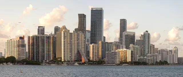
Miami's mangroves line Biscayne Bay, a subtropical estuary whose mangrove-lined shores, hardbottom and seagrass beds sit inside the 64,607 acre Biscayne Bay Aquatic Preserve, established in 1974 (FDEP Biscayne Bay Aquatic Preserve).
The Florida Department of Environmental Protection says the preserve runs the length of Biscayne Bay from the headwaters of the Oleta River south to Card Sound near Key Largo, lies east of Miami Dade County, and leaves out the waters of Biscayne National Park (FDEP). Its managers invite visitors to explore mangrove islands with magnificent frigatebirds and the bay's many spoil islands, and the preserve page links an Adopt-an-Island Program for Biscayne Bay.
Biscayne National Park, which shares boundaries with the preserve, protects one of the longest continuous stretches of mangroves left on Florida's East coast, according to the National Park Service (NPS Biscayne mangroves). Closer in, Virginia Key, a 1000-acre barrier island between the eastern shore of the City of Miami and the Village of Key Biscayne, is reached by the Rickenbacker Causeway in Biscayne Bay and is covered by a City of Miami master plan (City of Miami Virginia Key Master Plan).
| Place | Agency | Key fact |
|---|---|---|
| Biscayne Bay Aquatic Preserve | Florida DEP | 64,607 acres, Oleta River to Card Sound, established 1974 |
| Virginia Key | City of Miami (master plan) | 1000-acre barrier island, master plan completed July 22, 2010 |
| Biscayne National Park | National Park Service | One of the longest continuous mangrove stretches left on Florida's East coast |
Which mangroves grow on the Miami shoreline and how can they be told apart?
Three mangroves grow along Biscayne National Park's shorelines and island fringes, and the National Park Service says they line up from the water inland as red, then black, then white mangrove (NPS Biscayne mangroves).
Florida law, which Miami-Dade County carries out for mangrove trimming under a state delegation, uses the same three. The Mangrove Trimming and Preservation Act defines a mangrove as any white mangrove (Laguncularia racemosa), red mangrove (Rhizophora mangle) or black mangrove (Avicennia germinans), and it does not distinguish between living and dead mangroves, so the same trimming rules apply to each (FDEP Mangroves). Official sources differ on the Act's span: the FDEP page calls it the 1996 Act covering sections 403.9321 to 403.9334, while the current 2026 Florida Statutes say sections 403.9321 to 403.9333 may be cited as the Mangrove Trimming and Preservation Act (Florida Statutes 403.9321).
| Species | Where it grows | How to recognize it | Seed travel |
|---|---|---|---|
| Red mangrove | Muddy coastlines, roots spreading toward the sea in water as deep as three feet | Arching stilt-like prop roots | Propagules float up to a year |
| Black mangrove | Higher, drier tidal soils behind the red | Snorkel-like pneumatophores six or more inches tall | Seeds float up to four months |
| White mangrove | Furthest inland of the three | Two salt-excreting glands at the leaf base | Not stated by NPS |
Cold is a weak point for all three. The Biscayne National Park page says all mangroves have trouble with cold weather and freezes, and that the white mangrove is the least cold tolerant of the three (NPS). The black mangrove's pneumatophores let it take in oxygen even as the tide comes in.
The Florida DEP adds that mangroves serve as a nursery for many game and sport fisheries, and that mangrove trimming, Miami-Dade shorelines included, is regulated under the Mangrove Act (FDEP).
Can a Miami property owner trim or remove mangroves?
Only with permission: a Miami-Dade County Class I Permit is required for most mangrove trimming, alteration or removal anywhere in the county, including inside the City of Miami and the other municipalities (Miami-Dade Class I Environmental Permit).
Miami-Dade is one of the local governments the Florida DEP has delegated to run the state Mangrove Trimming and Preservation Act, and the state lists the county's number as 305-372-6575 for trimming questions in its area (FDEP delegated local governments). DEP says its district offices and delegated local governments are the ones that process mangrove trimming or alteration applications (FDEP Mangroves), and the delegation page says questions about trimming in a delegated area go to the responsible agency, which for Miami is the county (FDEP delegated local governments).
| Item | Detail |
|---|---|
| When required | Most mangrove trimming, alteration or removal; exceptions in Section 24-48 of the County Code |
| Fee basis | Square footage of the area proposed for trimming |
| Permit life | 3 years for mangrove trimming permits |
| Extensions | 2 or 3-year increments, no more than 10 years in total |
| Expedited authorization | Typically 10 days for qualifying work |
| Office | Coastal Resources Section, 701 NW 1st Court, 6th Floor, Miami; 305-372-6575; Monday to Friday 8:00 a.m. to 5:00 p.m. |
The Miami-Dade page says Class I review identifies potential environmental and other impacts and the county may require changes before a permit is issued and that mangrove trimming fees are based on the square footage of the area proposed for trimming (Miami-Dade County). Some qualifying work can get an expedited administrative authorization, typically processed in 10 days, if it meets the Section 24-48 criteria and the county finds no adverse environmental impact.
A practical Miami tip: the Coastal Resources Section works from Overtown Transit Village North at 701 NW 1st Court, and the county encourages a call to 305-372-6575 to discuss a particular case, since a Class I Permit must be obtained before work starts (Miami-Dade Class I permit). Last verified: October 15, 2026, on the Miami-Dade County website.
Where can Miami residents see mangroves up close?
Biscayne National Park's Convoy Point has a canoe and kayak launch open daily from 7 AM to 5:30 PM, and the park charges no entrance fee (NPS Biscayne hours).
The Dante Fascell Visitor Center at Convoy Point is open 7 days a week from 9 AM to 5 PM, and the navigable waters of the park are open 24 hours a day (NPS Biscayne hours). The National Park Service says Biscayne National Park has no entrance fees, while day use docking at Boca Chita and Elliott Keys costs $25.00 Friday through Monday and on federal holidays (NPS Biscayne fees).
The Biscayne National Park mailing address is 9700 SW 328th Street, Sir Lancelot Jones Way, Homestead, FL 33033, and its mangrove page describes the shoreline forest as a tangle of roots arching from the trunks in many directions (NPS Biscayne mangroves).
In the bay itself, the Florida DEP lists publicly accessible canoe and kayak launches at East Greynolds County Park, Oleta River State Park and the Deering Estate, and says the City of Miami works with the Biscayne Bay Aquatic Preserve on managing 11 of the preserve's 24 spoil islands (FDEP Biscayne Bay Aquatic Preserve).
What happened to the mangroves on Virginia Key?
The City of Miami planned to replace removed mangroves on Virginia Key's west shoreline next to Miami Marine Stadium by 2020, and its master plan page still lists that work as being processed (City of Miami Virginia Key Master Plan).
The City of Miami completed the Virginia Key master planning process on July 22, 2010, and the plan sets policies for land use and for the protection and enhancement of the island's natural resources (City of Miami). Miami Marine Stadium itself was built in 1963 and was declared unsafe and abandoned after Hurricane Andrew in 1992, according to the same city page.
Stale official data: as of October 15, 2026, the Miami page still describes the Virginia Key mangrove replacement as being processed with a 2020 completion date, and the neighboring Maritime Center item still gives 2021 as its expected finish (Virginia Key Master Plan). The page does not say whether the west shoreline replanting happened, so anyone following the Marine Stadium shoreline should ask the City of Miami Planning Department for the current status.
Work in the tidal waters or coastal wetlands of that Virginia Key shoreline would need a county Class I Permit, subject to the Section 24-48 exceptions, because the Miami-Dade permit covers those areas in every municipality in the county (Miami-Dade Class I permit).
Frequently asked questions
Is a permit needed to trim mangroves in Miami?
Yes, in most cases. Miami-Dade County requires a Class I Permit for most mangrove trimming, alteration or removal in the county and its municipalities, including the City of Miami. Exceptions are listed in Section 24-48 of the County Code. Call the Coastal Resources Section at 305-372-6575.
What are the three types of mangroves in Miami?
Red, black and white mangroves grow along Biscayne National Park's shorelines, and Florida law defines the same three. Red mangroves stand at the water's edge on prop roots, black mangroves grow behind them with snorkel-like pneumatophores, and white mangroves grow furthest inland.
Is it illegal to cut a dead mangrove in Miami?
Florida's Mangrove Trimming and Preservation Act does not distinguish between living and dead mangroves, so the same trimming rules apply. In Miami-Dade County, the work goes through the county's Class I permit process.
Where can visitors kayak near Miami's mangroves?
Biscayne National Park's Convoy Point has a canoe and kayak launch open daily from 7 AM to 5:30 PM, and the park charges no entrance fee. On Biscayne Bay, the Florida DEP lists public canoe and kayak launches at East Greynolds County Park, Oleta River State Park and the Deering Estate.
How long is a Miami-Dade mangrove trimming permit valid?
Miami-Dade County mangrove trimming permits are valid for 3 years from issuance. Extensions can be granted in 2 or 3-year increments, as long as the total extension time does not exceed 10 years.
Sources
- Class I Environmental Permit, Miami-Dade County https://www.miamidade.gov/permits/class-1.asp Used for: permit rule, validity, fees, office
- Mangroves, Florida Department of Environmental Protection https://floridadep.gov/water/submerged-lands-environmental-resources-coordination/content/mangroves Used for: Mangrove Act definition, nursery role, who processes
- Mangrove Trimming, Delegated Local Governments, FDEP https://floridadep.gov/water/submerged-lands-environmental-resources-coordination/content/mangrove-trimming-delegated Used for: Miami-Dade delegation and phone
- Biscayne Bay Aquatic Preserve, FDEP https://floridadep.gov/rcp/aquatic-preserve/locations/biscayne-bay-aquatic-preserves Used for: preserve size, extent, habitats
- Mangroves, Biscayne National Park (NPS) https://www.nps.gov/bisc/learn/nature/mangroves.htm Used for: species zonation and traits
- Fees, Biscayne National Park (NPS) https://www.nps.gov/bisc/planyourvisit/fees.htm Used for: no entrance fee, docking fee
- Operating Hours and Seasons, Biscayne National Park (NPS) https://www.nps.gov/bisc/planyourvisit/hours.htm Used for: visitor center and Convoy Point hours
- Virginia Key Master Plan, City of Miami https://www.miami.gov/My-Government/Departments/Planning/Virginia-Key-Master-Plan Used for: Virginia Key size, plan date, mangrove restoration
- Florida Statutes 403.9321 Short title, Online Sunshine http://www.leg.state.fl.us/statutes/index.cfm?App_mode=Display_Statute&URL=0400-0499/0403/Sections/0403.9321.html Used for: Mangrove Trimming and Preservation Act section span (403.9321-403.9333)
How this page was made
Digital Towns uses AI assistance to research and write its guides, and every page is only as good as the sources it cites. Our goal is the most accurate, useful local information possible.
This page was fact-checked twice before publishing.
If you see an error, or anything you can show is false, tell us right away and we will take a third look.
Report an error
Thank you. We'll take a third look and correct the page if it's wrong.