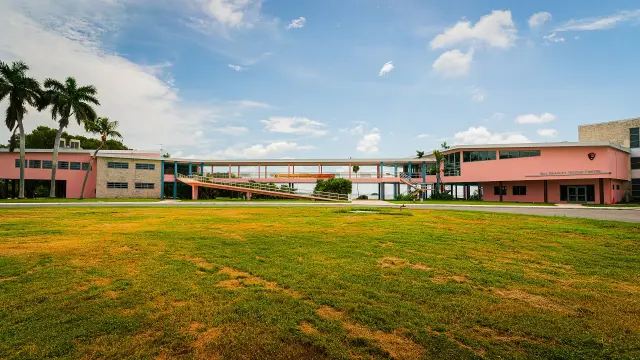
Short answer: Wabasso Causeway Park is a 13.4 acre Indian River County park in four lobes along County Road 510, where the Wabasso Causeway crosses the Indian River Lagoon south of Sebastian. It is open daily 7 a.m. to sunset and has a boat ramp 6 feet deep on the south-east lobe, 9 pavilions, 9 grills, 14 picnic tables, restrooms and river beaches for wading and canoes. Pets and alcohol are banned.
Last verified: October 15, 2026, against the sources listed at the end of this page.
Where is Wabasso Causeway Park and when is it open?
Wabasso Causeway Park is a 13.4 acre Indian River County park spread over four lobes along County Road 510, where the Wabasso Causeway crosses the Indian River Lagoon, open daily from 7 a.m. to sunset.
The county park page gives two street names for the same spot: its header reads 3105 Wabasso Bridge Road (County Road 510), and its description reads 3105 Wabasso Beach Road (CR 510) (Indian River County). County Road 510 is the constant in both. From Sebastian, the U.S. Fish and Wildlife Service directions to its Pelican Island refuge run along County Road 512 (Sebastian Boulevard), right on 90th Avenue, then straight onto County Road 510 toward A1A (USFWS, Pelican Island), the road that crosses the Wabasso Causeway.
| Feature | Count or detail | Lobe |
|---|---|---|
| Park size and hours | 13.4 acres, 7 a.m. to sunset daily | All four |
| Boat ramp | 6 feet deep at end of ramp | South-east |
| Restrooms | Yes | South-east |
| Pavilions | 9 | Not specified |
| Grills | 9 | Not specified |
| Picnic tables | 14 | Not specified |
| Parking | Boat trailer spaces and open parking | Not specified |
Last verified: October 14, 2026, on the Indian River County website (Wabasso Causeway Park page).
Where is the boat ramp at Wabasso Causeway Park and what speed rules apply?
The Wabasso Causeway Park boat ramp is on the south-east lobe, the same lobe as the restrooms, and Indian River County lists the water at 6 feet deep at the end of the ramp.
The county lists boat trailer parking spaces for the ramp but does not publish a count (Indian River County). Boaters leaving the Wabasso ramp are in manatee protection waters. Florida rule 68C-22.007 sets year-round Slow Speed zones in two areas that meet at the causeway: the Indian River from Big Slough to the Wabasso Beach Road Bridge, and from the Wabasso Beach Road Bridge south to Erwin Cove (Fla. Admin. Code R. 68C-22.007).
Each zone is drawn by shoreline distances, island outlines and channel markers rather than covering every inch of water. North of the bridge the rule names Collins Hole, Turtle Pen Slough and waters within 600 feet of shorelines, and south of it the zone sits east of a line 100 feet east of the Intracoastal Waterway channel (Fla. Admin. Code R. 68C-22.007). A practical reading for small boats launching at Wabasso Causeway Park: both zones meet at the bridge, so the posted manatee zone signs are worth checking before opening up.
Can people swim, fish or launch a kayak at Wabasso Causeway Park?
Indian River County lists beaches on the river at Wabasso Causeway Park for wading, fishing, sunbathing and canoes, along with plenty of shoreline for fishing and canoe launching.
The shoreline gives paddlers canoe launching spots, while the ramp on the south-east lobe, with boat trailer parking, serves trailered boats (Indian River County). No lifeguards are listed for the causeway beaches; a guarded county beach on the same road is Wabasso Beach Park at 1820 Wabasso Beach Road, staffed from 9:10 a.m. to 4:50 p.m. (Indian River County).
County ordinances limit what happens on the Wabasso Causeway lobes. Pets are not allowed (205.03.22), nor alcohol (205.03.26), and the park page also bans open fires, camping, overnight parking, fireworks, remote controlled aircraft and golfing (Indian River County). Unlike the county beach parks, the causeway page does not list a ban on equestrian activities.
What protected waters surround the Wabasso Causeway?
The Wabasso Causeway Boat Ramp is a listed access point to the Indian River-Malabar to Vero Beach Aquatic Preserve, a state preserve established in 1970 in Brevard and Indian River counties.
The Florida Department of Environmental Protection lists the preserve at 28,000 acres of Indian River Lagoon estuary and says the four lagoon aquatic preserves were designated Outstanding Florida Waters in 1979 (Florida DEP). The same agency's coastal access guide for Indian River County gives the preserve as 29,000 acres, on a page last modified on Feb. 24, 2025 (Florida DEP Coastal Access Guide), so two DEP pages disagree by 1,000 acres.
DEP explains that the lagoon's spoil islands were built from dredge material during construction of the Intracoastal Waterway, made of sand, shell, muck and limestone rubble, and have become an important biological and recreational part of the Indian River Lagoon (Florida DEP). The DEP coastal guide also lists the Indian River Blueway Trail and a segment of the Florida Circumnavigational Saltwater Paddling Trail in Indian River County (Florida DEP).
How old is the Wabasso bridge?
The current Wabasso causeway and high-arch bridge on County Road 510 date from 1970, when they replaced an earlier wooden bridge with a metal swing span.
The Florida Division of Historical Resources marker on County Road 510, placed in 2020, traces the crossing to Two Dollar Bluff, a landmark on the 1887 U.S. Geodetic map and a navigational aid for ships on the Indian River (Florida historical marker). The bluff was an Ais Indian midden on land owned by citrus grower A.B. Michael and became the Michael family dock; by 1927 most of the shell, pottery and bone in the midden had been hauled off as road material.
The marker says the dock gave way to the narrow wooden swing span bridge to the community of Orchid, which moved Indian River citrus from Orchid Island groves to the railroad and opened north Indian River County to tourism and land development (Florida historical marker). During World War II, only island residents could cross, and the bridge tender checked credentials. In 1970 the causeway and a high-arch span over the main channel replaced the old bridge, under the name Wabasso Bridge, and in 2020 the bridge was renamed the A.B. Michael Bridge.
What is near Wabasso Causeway Park?
Farther along Wabasso Beach Road sits the guarded Wabasso Beach Park, and the Pelican Island refuge trails sit 3.7 miles north of CR 510 on the Historic Jungle Trail.
Wabasso Beach Park is a 0.46 acre county beach at 1820 Wabasso Beach Road with 34 parking spaces, pavilions and restrooms (Indian River County). For the refuge, the Fish and Wildlife Service says to turn left (north) at A1A and, in 3.8 miles, left onto Jungle Trail; public use areas open daily from 7:30 a.m. until sunset, and the Centennial Trail address is 11455 Jungle Trail (USFWS, Pelican Island). A lagoon morning at the Wabasso Causeway lobes, a swim at Wabasso Beach and a Pelican Island walk can share one trip out of Sebastian.
Frequently asked questions
Is there a boat ramp at Wabasso Causeway Park?
Yes. Indian River County lists a boat ramp on the south-east lobe of Wabasso Causeway Park, 6 feet deep at the end of the ramp, with boat trailer parking. Restrooms are on the same lobe.
Are dogs allowed at Wabasso Causeway Park?
No. County Ordinance 205.03.22 prohibits pets in every Indian River County park, and the Wabasso Causeway Park page repeats the rule. Alcohol, fires, camping and overnight parking are also banned on the causeway lobes.
What are the hours at Wabasso Causeway Park?
Wabasso Causeway Park on County Road 510 is open daily from 7 a.m. to sunset, according to Indian River County. Overnight parking and trespassing after closing are prohibited by county ordinance.
Is the water near the Wabasso Causeway a manatee zone?
Yes. Florida rule 68C-22.007 sets year-round Slow Speed zones in defined Indian River waters both north and south of the Wabasso Beach Road (County Road 510) Bridge, measured from shorelines, islands and the Intracoastal channel.
What is the Wabasso bridge called now?
The 1970 high-arch bridge on the Wabasso Causeway was renamed the A.B. Michael Bridge in 2020, according to the Florida Division of Historical Resources marker on County Road 510.
Sources
- Wabasso Causeway Park, Indian River County Parks, Recreation and Conservation https://www.indianriver.gov/business_detail_T21_R34.php Used for: address, size, hours, lobes, amenities, ramp location and depth, restrooms, rules, south-east lobe launch and restrooms, shoreline for canoe launching, ordinance numbers
- Wabasso Beach Park, Indian River County https://www.indianriver.gov/business_detail_T21_R33.php Used for: ocean park at the east end of Wabasso Beach Road, lifeguard hours
- Visit Us, Pelican Island National Wildlife Refuge, USFWS https://www.fws.gov/refuge/pelican-island/visit-us Used for: route from Sebastian via CR 512, 90th Avenue and CR 510; Jungle Trail distance; refuge hours, I-95 exit 156 route detail, 3.8 miles to Jungle Trail, refuge office address and phone, Centennial Trail address
- Fla. Admin. Code R. 68C-22.007, Indian River County manatee zones (Cornell LII) https://www.law.cornell.edu/regulations/florida/Fla-Admin-Code-Ann-R-68C-22-007 Used for: year-round Slow Speed zones north and south of the Wabasso Beach Road bridge
- Indian River-Malabar to Vero Beach Aquatic Preserve, Florida DEP https://floridadep.gov/rcp/aquatic-preserve/locations/indian-river-malabar-vero-beach-aquatic-preserve Used for: preserve established 1970, 28,000 acres, spoil islands, Outstanding Florida Waters 1979, spoil island composition and vegetation, rookeries, Friends of the Spoil Islands, species list, best season, conservation efforts, Aquatic Preserves Act 1975
- Indian River County, Florida DEP Coastal Access Guide https://floridadep.gov/fco/coastal-access-guide/content/indian-river-county Used for: 29,000 acre preserve figure, Indian River Blueway, page last modified date
- A.B. Michael (Wabasso) Bridge marker, Florida Division of Historical Resources https://markers.flheritage.com/home/details/1133 Used for: Two Dollar Bluff, swing span bridge, World War II limits, 1970 causeway, 2020 renaming, marker location, navigational aid, 1927 midden loss, citrus to railroad, WWII credential checks, high-arch span, 1715 fleet
How this page was made
Digital Towns uses AI assistance to research and write its guides, and every page is only as good as the sources it cites. Our goal is the most accurate, useful local information possible.
This page was fact-checked twice before publishing.
If you see an error, or anything you can show is false, tell us right away and we will take a third look.
Report an error
Thank you. We'll take a third look and correct the page if it's wrong.